New Horizons Flyover Of Pluto
New Horizons Flyover of Pluto
Using actual New Horizons data and digital elevation models of Pluto and its largest moon Charon, mission scientists have created flyover movies that offer spectacular new perspectives of the many unusual features that were discovered and which have reshaped our views of the Pluto system – from a vantage point even closer than the spacecraft itself. This dramatic Pluto flyover begins over the highlands to the southwest of the great expanse of nitrogen ice plain informally named Sputnik Planitia. The viewer first passes over the western margin of Sputnik, where it borders the dark, cratered terrain of Cthulhu Macula, with the blocky mountain ranges located within the plains seen on the right. The tour moves north past the rugged and fractured highlands of Voyager Terra and then turns southward over Pioneer Terra – which exhibits deep and wide pits – before concluding over the bladed terrain of Tartarus Dorsa in the far east of the encounter hemisphere. Digital mapping and rendering were performed by Paul Schenk and John Blackwell of the Lunar and Planetary Institute in Houston.
More Posts from Fillthevoid-with-space and Others
Five Famous Pulsars from the Past 50 Years
Early astronomers faced an obstacle: their technology. These great minds only had access to telescopes that revealed celestial bodies shining in visible light. Later, with the development of new detectors, scientists opened their eyes to other types of light like radio waves and X-rays. They realized cosmic objects look very different when viewed in these additional wavelengths. Pulsars — rapidly spinning stellar corpses that appear to pulse at us — are a perfect example.

The first pulsar was observed 50 years ago on August 6, 1967, using radio waves, but since then we have studied them in nearly all wavelengths of light, including X-rays and gamma rays.
Typical Pulsar
Most pulsars form when a star — between 8 and 20 times the mass of our sun — runs out of fuel and its core collapses into a super dense and compact object: a neutron star.

These neutron stars are about the size of a city and can rotate slowly or quite quickly, spinning anywhere from once every few hours to hundreds of times per second. As they whirl, they emit beams of light that appear to blink at us from space.
First Pulsar
One day five decades ago, a graduate student at the University of Cambridge, England, named Jocelyn Bell was poring over the data from her radio telescope - 120 meters of paper recordings.

Image Credit: Sumit Sijher
She noticed some unusual markings, which she called “scruff,” indicating a mysterious object (simulated above) that flashed without fail every 1.33730 seconds. This was the very first pulsar discovered, known today as PSR B1919+21.
Best Known Pulsar
Before long, we realized pulsars were far more complicated than first meets the eye — they produce many kinds of light, not only radio waves. Take our galaxy’s Crab Nebula, just 6,500 light years away and somewhat of a local celebrity. It formed after a supernova explosion, which crushed the parent star’s core into a neutron star.

The resulting pulsar, nestled inside the nebula that resulted from the supernova explosion, is among the most well-studied objects in our cosmos. It’s pictured above in X-ray light, but it shines across almost the entire electromagnetic spectrum, from radio waves to gamma rays.
Brightest Gamma-ray Pulsar
Speaking of gamma rays, in 2015 our Fermi Gamma-ray Space Telescope discovered the first pulsar beyond our own galaxy capable of producing such high-energy emissions.

Located in the Tarantula Nebula 163,000 light-years away, PSR J0540-6919 gleams nearly 20 times brighter in gamma-rays than the pulsar embedded in the Crab Nebula.
Dual Personality Pulsar
No two pulsars are exactly alike, and in 2013 an especially fast-spinning one had an identity crisis. A fleet of orbiting X-ray telescopes, including our Swift and Chandra observatories, caught IGR J18245-2452 as it alternated between generating X-rays and radio waves.

Scientists suspect these radical changes could be due to the rise and fall of gas streaming onto the pulsar from its companion star.
Transformer Pulsar
This just goes to show that pulsars are easily influenced by their surroundings. That same year, our Fermi Gamma Ray Space Telescope uncovered another pulsar, PSR J1023+0038, in the act of a major transformation — also under the influence of its nearby companion star.

The radio beacon disappeared and the pulsar brightened fivefold in gamma rays, as if someone had flipped a switch to increase the energy of the system.
NICER Mission
Our Neutron star Interior Composition Explorer (NICER) mission, launched this past June, will study pulsars like those above using X-ray measurements.

With NICER’s help, scientists will be able to gaze even deeper into the cores of these dense and mysterious entities.
For more information about NICER, visit https://www.nasa.gov/nicer
Make sure to follow us on Tumblr for your regular dose of space: http://nasa.tumblr.com

Margaret Hamilton is a computer scientist and mathematician. She was the lead software engineer for Project Apollo. Her work prevented an abort of the Apollo 11 moon landing. She’s also credited for coining the term “software engineer."
A New Angle on Two Spiral Galaxies for Hubble’s 27th Birthday
In celebration of the 27th anniversary of the launch of NASA’s Hubble Space Telescope on April 24, 1990, astronomers used the legendary telescope to take a portrait of a stunning pair of spiral galaxies. This starry pair offers a glimpse of what our Milky Way galaxy would look like to an outside observer. The edge-on galaxy is called NGC 4302, and the tilted galaxy is NGC 4298. These galaxies look quite different because we see them angled at different positions on the sky. They are actually very similar in terms of their structure and contents. Image credit: NASA, ESA, and M. Mutchler (STScI) Read more NASA Media Usage Guidelines
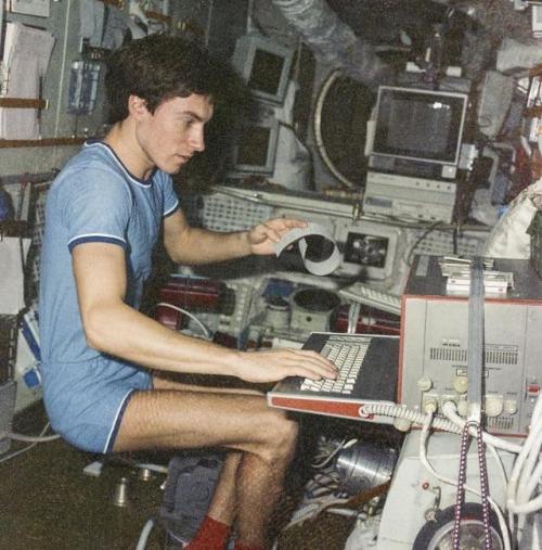
Soviet Cosmonaut Sergei Krikalev stuck in space during the collapse of the Soviet Union in 1991
Unable to return home, he ended up having to stay in space until further notice.
The cosmonaut eventually returned back to earth on March 25, 1992, after 10 months in orbit - to a nation that was very different to what it was when he had left. The Soviet Union had fractured into 15 nations, presidents had changed, and even his hometown of Leningrad had become St. Petersburg.
Interestingly, at the time, Krikalev was supposed to serve in the military reserves, and was almost issued a warrant for desertion – before the army realised that their reserve soldier was not even on the planet.
Shooting for an April first post date! I just started researching and hooboy, I am going to go way way way way down the rabbit hole of tangents. I think everything is interesting and cool.
Binary star systems have come up a lot in the past 18 podcasts, and here is a perfect example of them!


As promised, here is a comic about the brightest star in the northern Hemisphere: Sirius! Sirius B will be shown in future comics as 2018 is year of the dog and since Sirius is the dog star, it is year of the Sirius!
Enjoy!
https://www.space.com/21702-sirius-brightest-star.html

Did you know the government of New Mexico still considers Pluto to be a planet? In fact March 13th is “Pluto Planet Day”! So mark your calendars, it’s coming up.
Celebrating 17 Years of NASA’s ‘Little Earth Satellite That Could’
The satellite was little— the size of a small refrigerator; it was only supposed to last one year and constructed and operated on a shoestring budget — yet it persisted.
After 17 years of operation, more than 1,500 research papers generated and 180,000 images captured, one of NASA’s pathfinder Earth satellites for testing new satellite technologies and concepts comes to an end on March 30, 2017. The Earth Observing-1 (EO-1) satellite will be powered off on that date but will not enter Earth’s atmosphere until 2056.
“The Earth Observing-1 satellite is like The Little Engine That Could,” said Betsy Middleton, project scientist for the satellite at NASA’s Goddard Space Flight Center in Greenbelt, Maryland.
To celebrate the mission, we’re highlighting some of EO-1’s notable contributions to scientific research, spaceflight advancements and society.
Scientists Learn More About Earth in Fine Detail

This animation shifts between an image showing flooding that occurred at the Arkansas and Mississippi rivers on January 12, 2016, captured by ALI and the rivers at normal levels on February 14, 2015 taken by the Operational Land Imager on Landsat 8. Credit: NASA’s Earth Observatory
EO-1 carried the Advanced Land Imager that improved observations of forest cover, crops, coastal waters and small particles in the air known as aerosols. These improvements allowed researchers to identify smaller features on a local scale such as floods and landslides, which were especially useful for disaster support.

On the night of Sept. 6, 2014, EO-1’s Hyperion observed the ongoing eruption at Holuhraun, Iceland as shown in the above image. Partially covered by clouds, this scene shows the extent of the lava flows that had been erupting.
EO-1’s other key instrument Hyperion provided an even greater level of detail in measuring the chemical constituents of Earth’s surface— akin to going from a black and white television of the 1940s to the high-definition color televisions of today. Hyperion’s level of sophistication doesn’t just show that plants are present, but can actually differentiate between corn, sorghum and many other species and ecosystems. Scientists and forest managers used these data, for instance, to explore remote terrain or to take stock of smoke and other chemical constituents during volcanic eruptions, and how they change through time.
Crowdsourced Satellite Images of Disasters

EO-1 was one of the first satellites to capture the scene after the World Trade Center attacks (pictured above) and the flooding in New Orleans after Hurricane Katrina. EO-1 also observed the toxic sludge in western Hungary in October 2010 and a large methane leak in southern California in October 2015. All of these scenes, which EO-1 provided quick, high-quality satellite imagery of the event, were covered in major news outlets. All of these scenes were also captured because of user requests. EO-1 had the capability of being user-driven, meaning the public could submit a request to the team for where they wanted the satellite to gather data along its fixed orbits.

This image shows toxic sludge (red-orange streak) running west from an aluminum oxide plant in western Hungary after a wall broke allowing the sludge to spill from the factory on October 4, 2010. This image was taken by EO-1’s Advanced Land Imager on October 9, 2010. Credit: NASA’s Earth Observatory
Artificial Intelligence Enables More Efficient Satellite Collaboration

This image of volcanic activity on Antarctica’s Mount Erebus on May 7, 2004 was taken by EO-1’s Advanced Land Imager after sensing thermal emissions from the volcano. The satellite gave itself new orders to take another image several hours later. Credit: Earth Observatory
EO-1 was among the first satellites to be programmed with a form of artificial intelligence software, allowing the satellite to make decisions based on the data it collects. For instance, if a scientist commanded EO-1 to take a picture of an erupting volcano, the software could decide to automatically take a follow-up image the next time it passed overhead. The Autonomous Sciencecraft Experiment software was developed by NASA’s Jet Propulsion Laboratory in Pasadena, California, and was uploaded to EO-1 three years after it launched.

This image of Nassau Bahamas was taken by EO-1’s Advanced Land Imager on Oct 8, 2016, shortly after Hurricane Matthew hit. European, Japanese, Canadian, and Italian Space Agency members of the international coalition Committee on Earth Observation Satellites used their respective satellites to take images over the Caribbean islands and the U.S. Southeast coastline during Hurricane Matthew. Images were used to make flood maps in response to requests from disaster management agencies in Haiti, Dominican Republic, St. Martin, Bahamas, and the U.S. Federal Emergency Management Agency.
The artificial intelligence software also allows a group of satellites and ground sensors to communicate and coordinate with one another with no manual prompting. Called a “sensor web”, if a satellite viewed an interesting scene, it could alert other satellites on the network to collect data during their passes over the same area. Together, they more quickly observe and downlink data from the scene than waiting for human orders. NASA’s SensorWeb software reduces the wait time for data from weeks to days or hours, which is especially helpful for emergency responders.
Laying the Foundation for ‘Formation Flying’

This animation shows the Rodeo-Chediski fire on July 7, 2002, that were taken one minute apart by Landsat 7 (burned areas in red) and EO-1 (burned areas in purple). This precision formation flying allowed EO-1 to directly compare the data and performance from its land imager and the Landsat 7 ETM+. EO-1’s most important technology goal was to test ALI for future Landsat satellites, which was accomplished on Landsat 8. Credit: NASA’s Goddard Space Flight Center
EO-1 was a pioneer in precision “formation flying” that kept it orbiting Earth exactly one minute behind the Landsat 7 satellite, already in orbit. Before EO-1, no satellite had flown that close to another satellite in the same orbit. EO-1 used formation flying to do a side-by-side comparison of its onboard ALI with Landsat 7’s operational imager to compare the products from the two imagers. Today, many satellites that measure different characteristics of Earth, including the five satellites in NASA’s A Train, are positioned within seconds to minutes of one another to make observations on the surface near-simultaneously.
For more information on EO-1’s major accomplishments, visit: https://www.nasa.gov/feature/goddard/2017/celebrating-17-years-of-nasa-s-little-earth-satellite-that-could
Make sure to follow us on Tumblr for your regular dose of space: http://nasa.tumblr.com/.


Check out the makeshift pinhole-camera results from 99% totality! Leaves and my own hands work quite nicely to get an image of the little sliver of sunlight that was left. I had eclipse glasses but don't have any pictures from them: 99% is still not enough to reduce the sun's light very much. It got a little gloomier and I talked about it on Twitter but otherwise it was pretty uneventful! I'm glad I'm not on the road home from eclipsing. It would be cool to see totality one day, though.

This Black Eye Galaxy that got its name from the band of light absorbing dust appearing in front of the star systems bright center in the Hubble space telescope.
via reddit
-
 earthart1 reblogged this · 5 years ago
 -
 funneeb liked this · 6 years ago
 -
 heartfelt-elegy reblogged this · 7 years ago
 -
 a-shell-of-light liked this · 7 years ago
 -
 fillthevoid-with-space reblogged this · 7 years ago
 -
 rabovicci-blog liked this · 7 years ago
 -
 mevrim liked this · 7 years ago
 -
 skootdawg liked this · 7 years ago
 -
 otthonzulles reblogged this · 7 years ago
 -
otthonzulles liked this · 7 years ago
-
 nbarnabas reblogged this · 7 years ago
 -
 srtmnt reblogged this · 7 years ago
 -
 msspica reblogged this · 7 years ago
 -
 joe-a-nevem reblogged this · 7 years ago
 -
 sztupy reblogged this · 7 years ago
A podcast project to fill the space in my heart and my time that used to be filled with academic research. In 2018, that space gets filled with... MORE SPACE! Cheerfully researched, painstakingly edited, informal as hell, definitely worth everyone's time.
243 posts