Abandoned - Blog Posts
![100 Year Old Abandoned Masonic Castle Located In Upstate New York [980x490]](https://64.media.tumblr.com/2327861718ac13266808c6da5f7309f2/tumblr_pgkr3nymCg1uky4nio1_500.jpg)
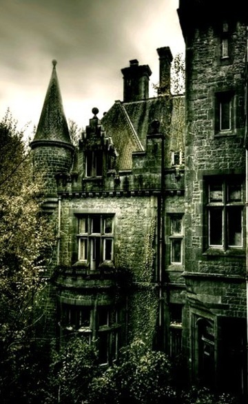
100 year old abandoned Masonic castle located in upstate New York [980x490]
Anaesthesia
A dystopian soldier concept.
I drew this in 12.5 hours using #ibispaintx on my tablet. Even now, I think I want to give her even more luscious locks and litter the floor with papers and clutter.
The columns look far too clean too. And what if I added a hole in the ceiling/roof and had another beam of light coming in? Could I get the effect of dust floating in the air or would the image quality just look terrible? Gah!
And she went on to add slightly more detail...

This has been heavy on my noggin:
Please hide me, God, deep in the ground— and when you are angry no more, remember to rescue me. Will we humans live again? I would gladly suffer and wait for my time. My Creator, you would want me; you would call out, and I would answer.
Job 14:13-15 CEVDCI

One of the "not known" place in Paris, abandoned metro line, Petite ceinture, hidden from tourist's eyes! I knew about this place before, but didn't know about its real location. To see the most scenic part of it you would need to go through long and dark tunnel :) P.S. no bats there😅🦇 . . . . . #paris #parisfrance #paris🇫🇷 #parisphoto #paris🗼 #visitparis #thisisparis #parisian #france #traveldeeper #travel #traveling #travelawesome #travellife #travelphotography #awesome_photographers #citybestpics #instatravel #sony #sonyalpha #placestovisit #travelblogger #bestplacestogo #wonderful_places #awesome_photographers #earthpix #abandonedplaces #amazingplaces #scenic #abandoned (at Paris, France) https://www.instagram.com/p/B8HCQ-mBZ0-/?igshid=154spfz1gswju

Commission for @/SkreeTwo on Twitter.
Character belongs to Skree.


I love drawing huge mega structures and abstract buildings. A lot inspired by Blame!

Announcement coming tomorrow…
Out of service: the Trieste-Opicina tramway

While the reopening of Notre-Dame cathedral in Paris is making big news, and while I'm in a bit of a tram phase on the blogs, spare a thought for the tram line between Trieste and Opicina, closed following an accident in 2016. And it's a real pity, because it was a wacky one.
Trieste is a city by the Adriatic Sea, surrounded by steep hills - and I mean steep. Opicina is 300 m higher, and the tram line features gradients as steep as 26% - link to the Hohentwiel hike for scale. Steel wheels on rails weren't going to be enough...

Initially, the steepest section was built as a rack-and-pinion railway, but in the late 1920s, it was replaced by a funicular system. Cable tractors would be coupled to the streetcars to push them up the hill, and control their descent on the way down - that's the curious boat-like vehicle in the photos (at least I'm getting boat vibes from it). The picture below shows just how steep the climb is.

In the later years of operation, these cable tractors were remotely controlled from the tram. The streetcars themselves date back to 1935, with wooden doors and fittings, making the Trieste-Opicina tramway a charming and technically unique heritage system.

Sadly, the line is not running. Two streetcars collided in 2016, they were repaired, but service has not resumed. One vehicle, coupled to the cable tractor, remains stationary at the foot of the climb, near where the second photo was taken. A look on Google Street View shows that cars are now habitually parked on the disused tracks. The number 2 tram route between Trieste and Opicina is currently served by the number 2/ bus.
Saint Servan and the Solidor Tower

On the right-hand side of the Rance river, just before the fortified city of Saint Malo on the estuary, is the smaller town of Saint Servan. In fact, it technically isn't a town anymore, it was absorbed by Saint Malo in the 1960s. But for most of history, there was a stark contrast between the two, as Saint Malo fiercely proclaimed its autonomy several times. Hence the Solidor Tower.

Consisting of three tightly-bunched round towers and their connections, the Solidor was built in the 14th century by the Dukes of Brittany as a means to control the Rance estuary, against the rebellious Saint Malo if needed.

Like other fortresses, such as the Bastille in Paris or the towers at La Rochelle (another time maybe), its strategic value soon dwindled, and it seemed best-suited to serve as a prison or as storage during the late 18th-early 19th centuries. It has been an officially classified monument since 1886, and had housed a maritime-themed museum since 1970, though this appears to be in limbo and I can't find the tower's current function.

A walk along the coast on the West side of Saint Servan will reveal a bit more history: an old lifeboat station, a small tower in the sea that serves as a tide gauge... further up, a WWII memorial with the remains of concrete bunkers, and further along, a view of Saint Malo. It's a worthwhile detour for people visiting Saint Malo, especially if you're concerned that the city centre will be too crowded. But I think I remember parking here wasn't easy either; on a nice day, the locals who don't want the hassle of "intra-muros" would come here.

Schauinsland

Since it's been mentioned in the comments on the previous post, we might as well have a look at the Schauinsland, a 1284 m peak on the outskirts of Freiburg im Breisgau. Only 7 km from the Schwabentor, the base is accessible by bus, before boarding a 3.6 km gondola lift ot the summit.

Opened in 1930, the Schauinslandbahn was the first gondola lift built for continuous operation, with the cabins running through each end station at slow speed to turn around while letting passengers off and on. The cable car takes the riders up the hill, offering panoramic views of the Black Forest. And then there's the view from the tower at the summit... I visited in summer, but it must be fantastic in winter too.

The cable car is not the only transport infrastructure to be found on the mountain, as mines operated there until the mid-20th century, so some mining railways with preserved vehicles can be found. Some of the tunnels can be visited (though writing this post reminds me, I haven't been inside yet).


Summer highlight reel: Île de la Table Ronde
To the South of Lyon, the "Island of the Round Table" in the middle of the Rhône offers a fantastic escape from the city. While the East side is exposed to a lot of noise from motorway traffic, the inside and West shore are gorgeous, and the southernmost end is a nature preserve.

The river flows by at a steady pace, making it a good spot for a reaction ferry similar to the ones in Basel. Fair play to the locals, they thought that too!


Bridges now do the job - though the suspension bridge from Vernaison isn't doing too well. Built in 1959, it needs replacing and until then, traffic is limited on it so as not to overload it. This hasn't been helped by the North side of the island being an industrial estate.

In the centre of the island, one finds a ruined farm, the Ferme aux Loups. One thing @teamroquette likes to do is geocaching, and so we looked for some, but the most elusive geocache of all was the namesake of the island. There are pictures of a round table associated with the island on Google Maps, but we missed it. That said, one Google review also mentions that they couldn't find it, so who knows.


We did find these interesting and somewhat imposing water level meters though. Lay on them to measure yourself... and get the wrong answer!
The abandoned Arzviller station

The old canal we followed yesterday is flanked by the Zorn river and the Strasbourg to Sarrebourg railway. Trains call at Lutzelbourg and/or Réding, while, half-way in between and opposite lock n°6, sits Arzviller station - actually located on the territory of Saint-Louis - closed. Shockingly, I can't find when it was closed (one source suggests the 1980s, though in my mind it was more recent).

Going from the canal to the station requires dropping down to the level of the Zorn river, crossing it, and going under the railway and road. There is a very dark underpass, but if you look closely and sport the light switch... Club Vosgien, the association which manages hiking trails in the Vosges mountains, literally shines through with this installation!


Given that Arzviller station is closed, and not wanting to tread the same ground twice, I decided to walk from one station to the next, Réding to Lutzelbourg, and I can't recommend the part from Réding to Arzviller: not signposted for hikers, really requiring a map if you're trying to avoid roads... and the only real highlight is the chance to glimpse the twin canal & railway tunnels: boats and trains enter and exit together at the West end (no boats on the day I visited though).

The abandoned Arzviller-Henridorff "lock ladder"

On my return to the Plan Incliné (previous post) in 2021, I added a walk along some of the section that the boat lift bypassed. The canal behind this door (lock n°17) has been closed and emptied, the tranquil flow replaced by an overgrown stream, but the paths along it have been maintained, and some sections added to improve the walking or cycling experience.

The lock houses, homes to the workers, are still standing, some used by artists as galleries and workshops.

The boat lift was created to bypass a system of 17 consecutive locks which took a whole day to traverse. I didn't go along the whole route to lock n°1 (I probably would have if Arzviller train station was still open), but beyond the "lock ladder" on the Western side is a 2 km canal tunnel, still in service today and a bit of a traffic jam, as it isn't wide enough for two boats to pass.

I probably should walk the whole route one day. As it's along a canal, it should be easy gradients, it's just the distance between Réding and Lutzelbourg train stations that needs to be covered. I think it'll be worth it, and a chance to see the entrances to the tunnels too.

Abandoned Cathedral by Wayne Pinkston Via Flickr: Website, Instagram, Facebook Abandoned Cathedral in Madagascar. This is the shell of an old abandoned cathedral in Madagascar. This was adjacent to a girls school and the priest was very nice to let us shoot there at night. There was no electricity in this region and the red glow on the horizon originates from multiple fires. The local people burn the fields to clear them and there are always multiple fires in the distance. Also bandits steal the cattle and set the villages on fire to keep the people from chasing them. 😳😬 This is a panorama of multiple vertical images. There is a Goal Zero lantern in the bell tower and a single light panel off to the right to provide Low Level Lighting on the outside. BTW, we had 3 armed guards at all times. Thanks to WorldPix and Ryan for setting up this trip! Thanks for looking! Wayne
Madagascar Cathedral by Wayne Pinkston Via Flickr: Website, Instagram, Facebook Panorama 12 frames, 14 mm, f/2.8, 15 sec., ISO 12,800 This is the shell of an abandoned Cathedral in Madagascar. I've added a crop from the center section. The red on the horizon is from fires. The local people burn the field and multiple fires could be seen at any one time. The glow from the fires could be seen from long distances at night. A big thank you to @worldpixorg and @ryanplakonouris for arranging this trip. @worldpixorg is a charity organization using photography to raise money for charitable causes. Hope you enjoy, Wayne Pinkston
Bell Tower by Wayne Pinkston Via Flickr: Website, Instagram, Facebook This one’s a bit abstract. We are looking up at the night sky and Milky Way in a bell tower of an old abandoned Cathedral in Madagascar. There is Low Level Lighting (LLL). The light inside the tower was a Goal Zero Micro Lantern, an omnidirectional light. The light outside was a Cineroid LED light panel set on 4000K and turned to low. ___________________________________________ There is a very large window in the front of the bell tower in the shape of a cross. Most of the glass has been broken out. ___________________________________________ There are 19 images stacked in Starry Landscape Stacker. 14-24 mm lens, 14 mm, 15 sec., f/2.8, ISO 12,800. Thanks for looking, Wayne
Abandoned Cathedral by Wayne Pinkston Via Flickr: Website, Instagram, Facebook Inside an abandoned Cathedral in Madagascar. The red on the horizon is from fires. The local people burn the fields to clear them. There is no public electricity and so there is no light pollution from electric lights. 14 images stacked in Starry Landscape Stacker, 11 light frames, 3 dark frames, 14-24 mm lens at 24 mm, f/2.8, 15 sec, ISO 10,000.


