Glaciers - Blog Posts

Completed color wheel thing that was going around on twitter. Waited to post the final result here. Made for a very fun drawing exercise!
Earth’s Land Ice by the Numbers
“At a glacial pace” used to mean moving so slowly the movement is almost imperceptible. Lately though, glaciers are moving faster. Ice on land is melting and flowing, sending water to the oceans, where it raises sea levels.

In 2018, we launched the Ice, Cloud and Land Elevation Satellite-2 (ICESat-2) to continue a global record of ice elevation. Now, the results are in. Using millions of measurements from a laser in space and quite a bit of math, researchers have confirmed that Earth is rapidly losing ice.

16 Years
ICESat-2 was a follow-up mission to the original ICESat, which launched in 2003 and took measurements until 2009. Comparing the two records tells us how much ice sheets have melted over 16 years.

½ Inch
During those 16 years, melting ice from Antarctica and Greenland was responsible for just over a half-inch of sea level rise. When ice on land melts, it eventually finds its way to the ocean. The rapid melt at the poles is no exception.

400,000 Olympic Swimming Pools
One gigaton of ice holds enough water to fill 400,000 Olympic swimming pools. It’s also enough ice to cover Central Park in New York in more than 1,000 feet of ice.

200 Gigatons
Between 2003 and 2019, Greenland lost 200 gigatons of ice per year. That’s 80 million Olympic swimming pools reaching the ocean every year, just from Greenland alone.

118 Gigatons
During the same time period, Antarctica lost 118 gigatons of ice per year. That’s another 47 million Olympic swimming pools every year. While there has been some elevation gain in the continent’s center from increased snowfall, it’s nowhere near enough to make up for how much ice is lost to the sea from coastal glaciers.

10,000 Pulses
ICESat-2 sends out 10,000 pulses of laser light a second down to Earth’s surface and times how long it takes them to return to the satellite, down to a billionth of a second. That’s how we get such precise measurements of height and changing elevation.

These numbers confirm what scientists have been finding in most previous studies and continue a long record of data showing how Earth’s polar ice is melting. ICESat-2 is a key tool in our toolbox to track how our planet is changing.
Make sure to follow us on Tumblr for your regular dose of space: http://nasa.tumblr.com.
Moving at the Speed of Arctic Ice
Time-lapses taken from space can help track how Earth’s polar regions are changing, watching as glaciers retreat and accelerate, and ice sheets melt over decades.

Using our long data record and a new computer program, we can watch Alaskan glaciers shift and flow every year since 1972. Columbia Glacier, which was relatively stable in the 1970s, has since retreated rapidly as the climate continues to warm.

The Malaspina Glacier has pulsed and spread and pulsed again. The flashes and imperfect frames in these time-lapses result from the need for cloud-free images from each year, and the technology limitations of the early generation satellites.

In Greenland, glaciers are also reacting to the warming climate. Glaciers are essentially frozen rivers, flowing across land. As they get warmer, they flow faster and lose more ice to the ocean. On average, glaciers in Greenland have retreated about 3 miles between 1985 and 2018. The amount of ice loss was fairly consistent for the first 15 years of the record, but started increasing around 2000.

Warmer temperatures also affect Greenland farther inland, where the surface of ice sheets and glaciers melts, forming lakes that can be up to 3 miles across. Over the last 20 years, the number of meltwater lakes forming in Greenland increased 27% and appeared at higher elevations, where temperatures were previously too cold for melt.

Whether they're studying how ice flows into the water, or how water pools atop ice, scientists are investigating some of the many aspects of how climate affects Earth's polar regions.
For more information, visit climate.nasa.gov.
Make sure to follow us on Tumblr for your regular dose of space: http://nasa.tumblr.com.
Perfect 10: A Decade of Studying Ice from the Sky
From 2009 through 2019, our Operation IceBridge flew planes above the Arctic, Antarctic and Alaska, measuring the height, depth, thickness, flow and change of sea ice, glaciers and ice sheets.

IceBridge was designed to “bridge” the years between NASA’s two Ice, Cloud, and land Elevation Satellites, ICESat and ICESat-2. IceBridge made its final polar flight in November 2019, one year after ICESat-2’s successful launch.
A lot of amazing science happens in a decade of fundamentally changing the way we see ice. Here, in chronological order, are 10 of IceBridge’s most significant and exciting achievements.
2009: Go for launch

The first ICESat monitored ice, clouds, atmospheric particles and vegetation globally beginning in 2003. As ICESat neared the end of its life, we made plans to keep measuring ice elevation with aircraft until ICESat-2’s launch.
ICESat finished its service in August 2009, leaving IceBridge in charge of polar ice tracking for the next decade.
2009: Snow on sea ice

To measure how thick sea ice is, we first have to know how much snow is accumulated on top of the ice. Using a snow radar instrument, IceBridge gathered the first widespread data set of snow thickness on top of both Arctic and Antarctic sea ice.
2009: Getting to the bottom of glaciers

IceBridge mapped hundreds of miles of grounding lines in both Antarctica and Greenland. Grounding lines are where a glacier’s bottom loses contact with the bedrock and begins floating on seawater – a grounding line that is higher than rock that the ice behind it is resting on increases the possibility of glaciers retreating in the future.
The team mapped 200 glaciers along Greenland’s coastal areas, as well as coastal areas, the interior of the Greenland Ice Sheet and high-priority areas in Antarctica.
2011: Spotting cracks in the ice

While flying Antarctica in 2011, IceBridge scientists spotted a massive crack in Pine Island Glacier, one of the fastest-changing glaciers on the continent. The crack produced a new iceberg that October.
Pine Island has grown thinner and more unstable in recent decades, spawning new icebergs almost every year. IceBridge watched for cracks that could lead to icebergs and mapped features like the deep water channel underneath Pine Island Glacier, which may bring warm water to its underside and make it melt faster.
2013: Making a map of rock

Using surface elevation, ice thickness and bedrock topography data from ICESat, IceBridge and international partners, the British Antarctic Survey created an updated map of the bedrock beneath Antarctic ice.
Taking gravity and magnetic measurements helps scientists understand what kind of rock lies below the ice sheet. Soft rock and meltwater make ice flow faster, while hard rock makes it harder for the ice to flow quickly.
2013: Surprises under the ice

IceBridge’s airborne radar data helped map the bedrock underneath the Greenland Ice Sheet, revealing a previously unknown canyon more than 400 miles long and up to a half mile deep slicing through the northern half of the country.
The “grand canyon” of Greenland may have once been a river system, and today likely transports meltwater from Greenland’s interior to the Arctic Ocean.
2015: It’s what’s inside (the ice sheet) that counts

After mapping the bedrock under the Greenland Ice Sheet, scientists turned their attention to the middle layers of the ice. Using both ice-penetrating radar and ice samples taken in the field, IceBridge created the first map of the ice sheet’s many layers, formed as thousands of years of snow became compacted downward and formed ice.
Making the 3D map of Greenland’s ice layers gave us clues as to how the ice sheet has warmed in the past, and where it may be frozen to bedrock or slowly melting instead.
2018: Gap bridged!

ICESat-2 launched on September 15, 2018, rocketing IceBridge into the final phase of its mission: Connecting ICESat and ICESat-2.
IceBridge continued flying after ICESat-2’s launch, working to verify the new satellite’s measurements. By conducting precise underflights, where planes traced the satellite’s orbit lines and took the same measurements at nearly the same time, the science teams could compare results and make sure ICESat-2’s instruments were functioning properly.
2018: An impact crater under the ice

Using IceBridge data, an international team of scientists found an impact crater from a meteor thousands of years in the past. The crater is larger than the city of Washington, D.C., likely created by a meteor more than half a mile wide.
2019: Flying into the sunset

In 2019, IceBridge continued flying in support of ICESat-2 for its Arctic and Antarctic campaigns. The hundreds of terabytes of data the team collected over the decade will fuel science for years to come.
IceBridge finished its last polar flight on November 20, 2019. The team will complete one more set of Alaska flights in 2020.
Make sure to follow us on Tumblr for your regular dose of space: http://nasa.tumblr.com

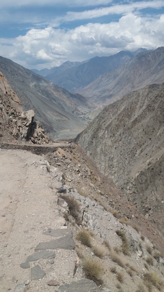
One of those views you can just admire all day 😍 This looks like a mountain lovers paradise! Who can guess where this is? Comment below 👇🏼 Photo by: @noah.leimgruber Use #wildsupply to be featured 📷 . . . . . #mountainside #mountainviews #landscape_lover #glacier #glaciers #mountainporn #peaceful #paradisevalley #travelgoals


I so wanna go back!! 🥲

Glacier area on Mount Kilimanjaro on the Kenya/Tanzania border in East Africa decreased 85% 1912-2007; from 12.06km2 to 1.85km2. While the loss of glaciers in temperate regions (such as those in the U.S.) has been attributed to warming temperatures from climate change, glacier loss on Kilimanjaro is more likely a result of a local climate change in East Africa that occurred in the late 1800s, resulting in a drier climate. However, causes of the dramatic glacier loss remain largely unknown.
Source: Thompson, L. G., Hardy, D. R., Mark, B. G., Brecher, H. H., & Mosley-Thompson, E. (2009). Glacier loss on Kilimanjaro continues unabated. Proceedings of the National Academy of Sciences of the United States of America, 106(47), 19770-19775.
Glaciers are losing billions and billions of tons of ice each year
Glaciers have lost more than 9 trillion tons of ice since 1961. Glaciers lost more than 9 trillion tons (that’s 9,625,000,000,000 tons) of ice between 1961 and 2016, according to new research. The loss led to a 27-millimeter increase in global sea levels over this period, researchers found
Source: http://bit.ly/2Vycmo3
The post Glaciers are losing billions and billions of tons of ice each year appeared first on NosyTalk.
from WordPress https://nosytalk.com/glaciers-are-losing-billions-and-billions-of-tons-of-ice-each-year/?utm_source=rss&utm_medium=rss&utm_campaign=glaciers-are-losing-billions-and-billions-of-tons-of-ice-each-year