Earth - Blog Posts

For Earth Day, we’re inviting you to take a moment to celebrate our wonderful water world, Earth. As far as we know, our Blue Marble is the only place in the universe with life, and that life depends on water. Snap a photo of yourself outside and tag it #GlobalSelfie – bonus points if your selfie features your favorite body of water! http://go.nasa.gov/3xFt0H0
Make sure to follow us on Tumblr for your regular dose of space!

On Monday, April 8, 2024, there’ll be a total solar eclipse – and it’ll be the last one to cross North America for 20 years. Make sure you’re tuned in to our live broadcast for this exciting event: there’ll be views from along the path of totality, special guests, and plenty of science.
Make sure to follow us on Tumblr for your regular dose of space!
Do You Love the Color of the Sun?

Get dazzled by the true spectrum of solar beauty. From fiery reds to cool blues, explore the vibrant hues of the Sun in a mesmerizing color order. The images used to make this gradient come from our Solar Dynamics Observatory. Taken in a variety of wavelengths, they give scientists a wealth of data about the Sun. Don't miss the total solar eclipse crossing North America on April 8, 2024. (It's the last one for 20 years!) Set a reminder to watch with us.


Sharpening Our View of Climate Change with the Plankton, Aerosol, Cloud, ocean Ecosystem Satellite
As our planet warms, Earth’s ocean and atmosphere are changing.
Climate change has a lot of impact on the ocean, from sea level rise to marine heat waves to a loss of biodiversity. Meanwhile, greenhouse gases like carbon dioxide continue to warm our atmosphere.
NASA’s upcoming satellite, PACE, is soon to be on the case!
Set to launch on Feb. 6, 2024, the Plankton, Aerosol, Cloud, ocean Ecosystem (PACE) mission will help us better understand the complex systems driving the global changes that come with a warming climate.

Earth’s ocean is becoming greener due to climate change. PACE will see the ocean in more hues than ever before.
While a single phytoplankton typically can’t be seen with the naked eye, communities of trillions of phytoplankton, called blooms, can be seen from space. Blooms often take on a greenish tinge due to the pigments that phytoplankton (similar to plants on land) use to make energy through photosynthesis.
In a 2023 study, scientists found that portions of the ocean had turned greener because there were more chlorophyll-carrying phytoplankton. PACE has a hyperspectral sensor, the Ocean Color Instrument (OCI), that will be able to discern subtle shifts in hue. This will allow scientists to monitor changes in phytoplankton communities and ocean health overall due to climate change.

Phytoplankton play a key role in helping the ocean absorb carbon from the atmosphere. PACE will identify different phytoplankton species from space.
With PACE, scientists will be able to tell what phytoplankton communities are present – from space! Before, this could only be done by analyzing a sample of seawater.
Telling “who’s who” in a phytoplankton bloom is key because different phytoplankton play vastly different roles in aquatic ecosystems. They can fuel the food chain and draw down carbon dioxide from the atmosphere to photosynthesize. Some phytoplankton populations capture carbon as they die and sink to the deep ocean; others release the gas back into the atmosphere as they decay near the surface.
Studying these teeny tiny critters from space will help scientists learn how and where phytoplankton are affected by climate change, and how changes in these communities may affect other creatures and ocean ecosystems.

Climate models are one of our most powerful tools to understand how Earth is changing. PACE data will improve the data these models rely on.
The PACE mission will offer important insights on airborne particles of sea salt, smoke, human-made pollutants, and dust – collectively called aerosols – by observing how they interact with light.
With two instruments called polarimeters, SPEXone and HARP2, PACE will allow scientists to measure the size, composition, and abundance of these microscopic particles in our atmosphere. This information is crucial to figuring out how climate and air quality are changing.
PACE data will help scientists answer key climate questions, like how aerosols affect cloud formation or how ice clouds and liquid clouds differ.
It will also enable scientists to examine one of the trickiest components of climate change to model: how clouds and aerosols interact. Once PACE is operational, scientists can replace the estimates currently used to fill data gaps in climate models with measurements from the new satellite.

With a view of the whole planet every two days, PACE will track both microscopic organisms in the ocean and microscopic particles in the atmosphere. PACE’s unique view will help us learn more about the ways climate change is impacting our planet’s ocean and atmosphere.
Stay up to date on the NASA PACE blog, and make sure to follow us on Tumblr for your regular dose of sPACE!

Six Answers to Questions You’re Too Embarrassed to Ask about the Hottest Year on Record
You may have seen the news that 2023 was the hottest year in NASA’s record, continuing a trend of warming global temperatures. But have you ever wondered what in the world that actually means and how we know?
We talked to some of our climate scientists to get clarity on what a temperature record is, what happened in 2023, and what we can expect to happen in the future… so you don’t have to!

1. Why was 2023 the warmest year on record?
The short answer: Human activities. The release of greenhouse gases like carbon dioxide and methane into the atmosphere trap more heat near Earth’s surface, raising global temperatures. This is responsible for the decades-long warming trend we’re living through.
But this year’s record wasn’t just because of human activities. The last few years, we’ve been experiencing the cooler phase of a natural pattern of Pacific Ocean temperatures called the El Niño Southern Oscillation (ENSO). This phase, known as La Niña, tends to cool temperatures slightly around the world. In mid-2023, we started to shift into the warmer phase, known as El Niño. The shift ENSO brought, combined with overall human-driven warming and other factors we’re continuing to study, pushed 2023 to a new record high temperature.

2. So will every year be a record now?
Almost certainly not. Although the overall trend in annual temperatures is warmer, there’s some year-to-year variation, like ENSO we mentioned above.
Think about Texas and Minnesota. On the whole, Texas is warmer than Minnesota. But some days, stormy weather could bring cooler temperatures to Texas while Minnesota is suffering through a local heat wave. On those days, the weather in Minnesota could be warmer than the weather in Texas. That doesn’t mean Minnesota is warmer than Texas overall; we’re just experiencing a little short-term variation.
Something similar happens with global annual temperatures. The globe will naturally shift back to La Niña in the next few years, bringing a slight cooling effect. Because of human carbon emissions, current La Niña years will be warmer than La Niña years were in the past, but they’ll likely still be cooler than current El Niño years.

3. What do we mean by “on record”?
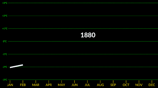
Technically, NASA’s global temperature record starts in 1880. NASA didn’t exist back then, but temperature data were being collected by sailing ships, weather stations, and scientists in enough places around the world to reconstruct a global average temperature. We use those data and our modern techniques to calculate the average.
We start in 1880, because that’s when thermometers and other instruments became technologically advanced and widespread enough to reliably measure and calculate a global average. Today, we make those calculations based on millions of measurements taken from weather stations and Antarctic research stations on land, and ships and ocean buoys at sea. So, we can confidently say 2023 is the warmest year in the last century and a half.

However, we actually have a really good idea of what global climate looked like for tens of thousands of years before 1880, relying on other, indirect ways of measuring temperature. We can look at tree rings or cores drilled from ice sheets to reconstruct Earth’s more ancient climate. These measurements affirm that current warming on Earth is happening at an unprecedented speed.
4. Why does a space agency keep a record of Earth’s temperature?
It’s literally our job! When NASA was formed in 1958, our original charter called for “the expansion of human knowledge of phenomena in the atmosphere and space.” Our very first space missions uncovered surprises about Earth, and we’ve been using the vantage point of space to study our home planet ever since. Right now, we have a fleet of more than 20 spacecraft monitoring Earth and its systems.
Why we created our specific surface temperature record – known as GISTEMP – actually starts about 25 million miles away on the planet Venus. In the 1960s and 70s, researchers discovered that a thick atmosphere of clouds and carbon dioxide was responsible for Venus’ scorchingly hot temperatures.

Dr. James Hansen was a scientist at the Goddard Institute for Space Studies in New York, studying Venus. He realized that the greenhouse effect cooking Venus’ surface could happen on Earth, too, especially as human activities were pumping carbon dioxide into our atmosphere.
He started creating computer models to see what would happen to Earth’s climate as more carbon dioxide entered the atmosphere. As he did, he needed a way to check his models – a record of temperatures at Earth’s surface over time, to see if the planet was indeed warming along with increased atmospheric carbon. It was, and is, and NASA’s temperature record was born.
5. If last year was record hot, why wasn’t it very hot where I live?
The temperature record is a global average, so not everywhere on Earth experienced record heat. Local differences in weather patterns can influence individual locations to be hotter or colder than the globe overall, but when we average it out, 2023 was the hottest year.
Just because you didn’t feel record heat this year, doesn’t mean you didn’t experience the effects of a warming climate. 2023 saw a busy Atlantic hurricane season, low Arctic sea ice, raging wildfires in Canada, heat waves in the U.S. and Australia, and more.

And these effects don’t stay in one place. For example, unusually hot and intense fires in Canada sent smoke swirling across the entire North American continent, triggering some of the worst air quality in decades in many American cities. Melting ice at Earth’s poles drives rising sea levels on coasts thousands of miles away.

6. Speaking of which, why is the Arctic – one of the coldest places on Earth – red on this temperature map?
Our global temperature record doesn’t actually track absolute temperatures. Instead, we track temperature anomalies, which are basically just deviations from the norm. Our baseline is an average of the temperatures from 1951-1980, and we compare how much Earth’s temperature has changed since then.
Why focus on anomalies, rather than absolutes? Let’s say you want to track if apples these days are generally larger, smaller, or the same size as they were 20 years ago. In other words, you want to track the change over time.
Apples grown in Florida are generally larger than apples grown in Alaska. Like, in real life, how Floridian temperatures are generally much higher than Alaskan temperatures. So how do you track the change in apple sizes from apples grown all over the world while still accounting for their different baseline weights?
By focusing on the difference within each area rather than the absolute weights. So in our map, the Arctic isn’t red because it’s hotter than Bermuda. It’s red because it’s gotten relatively much warmer than Bermuda has in the same time frame.
Want to learn more about climate change? Dig into the data at climate.nasa.gov.
Make sure to follow us on Tumblr for your regular dose of space!
Confirmed: Summer 2023 Hottest in NASA’s Record
All three months of summer 2023 broke records. July 2023 was the hottest month ever recorded, and the hottest July. June 2023 was the hottest June, and August 2023 was the hottest August.
NASA’s temperature record, GISTEMP, starts in 1880, when consistent, modern recordkeeping became possible. Our record uses millions of measurements of surface temperature from weather stations, ships and ocean buoys, and Antarctic research stations. Other agencies and organizations who keep similar global temperature records find the same pattern of long-term warming.
Global temperatures are rising from increased emissions of greenhouse gasses, like carbon dioxide and methane. Over the last 200 years, humans have raised atmospheric CO2 by nearly 50%, primarily through the burning of fossil fuels.
Drivers of climate change, both natural and human-caused, leave distinct fingerprints. Through observations and modeling, NASA researchers confirm that the current warming is the result of human activities, particularly increased greenhouse gas emissions.
NASA Inspires Your Crafty Creations for World Embroidery Day
It’s amazing what you can do with a little needle and thread! For #WorldEmbroideryDay, we asked what NASA imagery inspired you. You responded with a variety of embroidered creations, highlighting our different areas of study.
Here’s what we found:
Webb’s Carina Nebula

Wendy Edwards, a project coordinator with Earth Science Data Systems at NASA, created this embroidered piece inspired by Webb’s Carina Nebula image. Captured in infrared light, this image revealed for the first time previously invisible areas of star birth. Credit: Wendy Edwards, NASA. Pattern credit: Clare Bray, Climbing Goat Designs
Wendy Edwards, a project coordinator with Earth Science Data Systems at NASA, first learned cross stitch in middle school where she had to pick rotating electives and cross stitch/embroidery was one of the options. “When I look up to the stars and think about how incredibly, incomprehensibly big it is out there in the universe, I’m reminded that the universe isn’t ‘out there’ at all. We’re in it,” she said. Her latest piece focused on Webb’s image release of the Carina Nebula. The image showcased the telescope’s ability to peer through cosmic dust, shedding new light on how stars form.
Ocean Color Imagery: Exploring the North Caspian Sea

Danielle Currie of Satellite Stitches created a piece inspired by the Caspian Sea, taken by NASA’s ocean color satellites. Credit: Danielle Currie/Satellite Stitches
Danielle Currie is an environmental professional who resides in New Brunswick, Canada. She began embroidering at the beginning of the Covid-19 pandemic as a hobby to take her mind off the stress of the unknown. Danielle’s piece is titled “46.69, 50.43,” named after the coordinates of the area of the northern Caspian Sea captured by LandSat8 in 2019.

An image of the Caspian Sea captured by Landsat 8 in 2019. Credit: NASA
Two Hubble Images of the Pillars of Creation, 1995 and 2015

Melissa Cole of Star Stuff Stitching created an embroidery piece based on the Hubble image Pillars of Creation released in 1995. Credit: Melissa Cole, Star Stuff Stitching
Melissa Cole is an award-winning fiber artist from Philadelphia, PA, USA, inspired by the beauty and vastness of the universe. They began creating their own cross stitch patterns at 14, while living with their grandparents in rural Michigan, using colored pencils and graph paper. The Pillars of Creation (Eagle Nebula, M16), released by the Hubble Telescope in 1995 when Melissa was just 11 years old, captured the imagination of a young person in a rural, religious setting, with limited access to science education.

Lauren Wright Vartanian of the shop Neurons and Nebulas created this piece inspired by the Hubble Space Telescope’s 2015 25th anniversary re-capture of the Pillars of Creation. Credit: Lauren Wright Vartanian, Neurons and Nebulas
Lauren Wright Vartanian of Guelph, Ontario Canada considers herself a huge space nerd. She’s a multidisciplinary artist who took up hand sewing after the birth of her daughter. She’s currently working on the illustrations for a science themed alphabet book, made entirely out of textile art. It is being published by Firefly Books and comes out in the fall of 2024. Lauren said she was enamored by the original Pillars image released by Hubble in 1995. When Hubble released a higher resolution capture in 2015, she fell in love even further! This is her tribute to those well-known images.
James Webb Telescope Captures Pillars of Creation

Darci Lenker of Darci Lenker Art, created a rectangular version of Webb’s Pillars of Creation. Credit: Darci Lenker of Darci Lenker Art
Darci Lenker of Norman, Oklahoma started embroidery in college more than 20 years ago, but mainly only used it as an embellishment for her other fiber works. In 2015, she started a daily embroidery project where she planned to do one one-inch circle of embroidery every day for a year. She did a collection of miniature thread painted galaxies and nebulas for Science Museum Oklahoma in 2019. Lenker said she had previously embroidered the Hubble Telescope’s image of Pillars of Creation and was excited to see the new Webb Telescope image of the same thing. Lenker could not wait to stitch the same piece with bolder, more vivid colors.
Milky Way

Darci Lenker of Darci Lenker Art was inspired by NASA’s imaging of the Milky Way Galaxy. Credit: Darci Lenker
In this piece, Lenker became inspired by the Milky Way Galaxy, which is organized into spiral arms of giant stars that illuminate interstellar gas and dust. The Sun is in a finger called the Orion Spur.
The Cosmic Microwave Background

This image shows an embroidery design based on the cosmic microwave background, created by Jessica Campbell, who runs Astrostitches. Inside a tan wooden frame, a colorful oval is stitched onto a black background in shades of blue, green, yellow, and a little bit of red. Credit: Jessica Campbell/ Astrostitches
Jessica Campbell obtained her PhD in astrophysics from the University of Toronto studying interstellar dust and magnetic fields in the Milky Way Galaxy. Jessica promptly taught herself how to cross-stitch in March 2020 and has since enjoyed turning astronomical observations into realistic cross-stitches. Her piece was inspired by the cosmic microwave background, which displays the oldest light in the universe.

The full-sky image of the temperature fluctuations (shown as color differences) in the cosmic microwave background, made from nine years of WMAP observations. These are the seeds of galaxies, from a time when the universe was under 400,000 years old. Credit: NASA/WMAP Science Team
GISSTEMP: NASA’s Yearly Temperature Release

Katy Mersmann, a NASA social media specialist, created this embroidered piece based on NASA’s Goddard Institute for Space Studies (GISS) global annual temperature record. Earth’s average surface temperature in 2020 tied with 2016 as the warmest year on record. Credit: Katy Mersmann, NASA
Katy Mersmann is a social media specialist at NASA’s Goddard Space Flight Center in Greenbelt, Md. She started embroidering when she was in graduate school. Many of her pieces are inspired by her work as a communicator. With climate data in particular, she was inspired by the researchers who are doing the work to understand how the planet is changing. The GISTEMP piece above is based on a data visualization of 2020 global temperature anomalies, still currently tied for the warmest year on record.
In addition to embroidery, NASA continues to inspire art in all forms. Check out other creative takes with Landsat Crafts and the James Webb Space telescope public art gallery.
Make sure to follow us on Tumblr for your regular dose of space!

Space Craft! Make NASA-Inspired Creations for World Embroidery Day
It’s time to get crafty with some needle and thread. At NASA, we hope to inspire art of all kinds. To highlight #WorldEmbroideryDay on July 30, we want to know: does our imagery inspire you? Show us your art and we may feature it on social media.
How?
Search for a NASA image that inspires you. Here are a few places to get you started: Hubble, James Webb Space Telescope, Ocean Color, Landsat and Earth Observatory
Create. Over the years, we've seen a growing number of embroidered pieces that showcase our organization's research, especially with needlepoint.
Share your creation, along with the image it was inspired by, on social media using the hashtag #NASAEmbroidery. We will share selected pieces on July 30 for World Embroidery Day
Why?

NASA imagery has many functions. From studying distant galaxies to tracking ocean health, our scientists use these images to not only monitor our home planet, but better understand life beyond our solar system.
Embroidery is an ancient craft that has experienced a revival over the years. It involves decorating fabric or other materials using a needle to apply thread or yarn. Have you recently taken up embroidery? What images are you inspired by? We’d love to see it.
Image Resources for #NASAEmbroidery Inspiration
NASA Images
Hubble Image Gallery
NASA’s Ocean Color Image Gallery
James Webb Space Telescope
Landsat Image Gallery
Create and Share Your #NASAEmbroidery
Take a picture of your piece and upload it to Twitter, Instagram, Tumblr or Facebook. Make sure you use the hashtag #NASAEmbroidery so we know that you are taking part in the event and make sure that your privacy permissions allow us to view your post.
If the piece catches our eye, we may share your work on NASA’s main social media accounts as well as theme-related ones. We may also feature your art in a NASA Flickr gallery and our Tumblr pages. We’ll contact you directly to grant us permission to feature your work. You can follow @NASA on Twitter, Instagram and Facebook for embroidery creations, which will be featured from July 30-Aug. 1
Make sure to follow us on Tumblr for your regular dose of space!

Ways NASA Studies the Ocean
We live on a water planet. The ocean covers a huge part of the Earth's surface – earning it the name Blue Marble.
The ocean is one of Earth’s largest ecosystems and helps moderate Earth’s climate. NASA scientists spend a lot of time studying the ocean and how it is changing as Earth’s climate changes.
In the last few years, NASA has launched an array of missions dedicated to studying this precious part of our planet, with more to come. For World Oceans Month, which starts in June, here are new ways NASA studies the ocean.
1. Seeing the colors of the ocean 🎨
A new NASA mission called PACE will see Earth’s oceans in more color than ever before. The color of the ocean is determined by the interaction of sunlight with substances or particles present in seawater.
Scheduled to launch in 2024, PACE will help scientists assess ocean health by measuring the distribution of phytoplankton, tiny plants and algae that sustain the marine food web. PACE will also continue measuring key atmospheric variables associated with air quality and Earth's climate.

2. Surveying surface water around the globe 💧
The SWOT satellite, launched in late 2022, is studying Earth’s freshwater – from oceans and coasts to rivers, lakes and more – to create the first global survey of Earth’s surface water.
SWOT is able to measure the elevation of water, observing how major bodies of water are changing and detecting ocean features. The data SWOT collects will help scientists assess water resources, track regional sea level changes, monitor changing coastlines, and observe small ocean currents and eddies.

3. Setting sail to understand interactions between the ocean and atmosphere 🚢
With research aircraft, a research ship, and autonomous ocean instruments like gliders, NASA’s S-MODE mission is setting sail to study Earth’s oceans up close. Their goal? To understand ocean whirlpools, eddies and currents.
These swirling ocean features drive the give-and-take of nutrients and energy between the ocean and atmosphere and, ultimately, help shape Earth’s climate.

4. Building ocean satellites the size of a shoebox 📦
NASA’s HawkEye instrument collects ocean color data and captures gorgeous images of Earth from its orbit just over 355 miles (575 kilometers) above Earth’s surface. It’s also aboard a tiny satellite measuring just 10cm x 10 cm x 30 cm – about the size of a shoebox!

5. Designing new missions to study Earth’s oceans! 🌊
NASA is currently designing a new space-based instrument called GLIMR that will help scientists observe and monitor oceans throughout the Gulf of Mexico, the southeastern U.S. coastline and the Amazon River plume that stretches to the Atlantic Ocean. GLIMR will also provide important information about oil spills, harmful algae blooms, water quality and more to local agencies.

6. Taking the ocean to new heights ⬆️
The U.S.-European Sentinel-6 Michael Freilich satellite is helping researchers measure the height of the ocean - a key component in understanding how Earth’s climate is changing.
This mission, which launched in 2020, has a serious job to do. It’s not only helping meteorologists improve their weather forecasts, but it’s helping researchers understand how climate change is changing Earth’s coastlines in real time.
Make sure to follow us on Tumblr for your regular dose of space!
Why Isn’t Every Year the Warmest Year on Record?
This just in: 2022 effectively tied for the fifth warmest year since 1880, when our record starts. Here at NASA, we work with our partners at NOAA to track temperatures across Earth’s entire surface, to keep a global record of how our planet is changing.
Overall, Earth is getting hotter.

The warming comes directly from human activities – specifically, the release of greenhouse gases like carbon dioxide from burning fossil fuels. We started burning fossil fuels in earnest during the Industrial Revolution. Activities like driving cars and operating factories continue to release greenhouse gases into our atmosphere, where they trap heat in the atmosphere.

So…if we’re causing Earth to warm, why isn’t every year the hottest year on record?
As 2022 shows, the current global warming isn’t uniform. Every single year isn’t necessarily warmer than every previous year, but it is generally warmer than most of the preceding years. There’s a warming trend.
Earth is a really complex system, with various climate patterns, solar activity, and events like volcanic eruptions that can tip things slightly warmer or cooler.
Climate Patterns
While 2021 and 2022 continued a global trend of warming, they were both a little cooler than 2020, largely because of a natural phenomenon known as La Niña.
La Niña is one third of a climate phenomenon called El Niño Southern Oscillation, also known as ENSO, which can have significant effects around the globe. During La Niña years, ocean temperatures in the central and eastern Pacific Ocean cool off slightly. La Niña’s twin, El Niño brings warmer temperatures to the central and eastern Pacific. Neutral years bring ocean temperatures in the region closer to the average.

El Niño and La Niña affect more than ocean temperatures – they can bring changes to rainfall patterns, hurricane frequency, and global average temperature.
We’ve been in a La Niña mode the last three, which has slightly cooled global temperatures. That’s one big reason 2021 and 2022 were cooler than 2020 – which was an El Niño year.
Overall warming is still happening. Current El Niño years are warmer than previous El Niño years, and the same goes for La Niña years. In fact, enough overall warming has occurred that most current La Niña years are warmer than most previous El Niño years. This year was the warmest La Niña year on record.

Solar Activity
Our Sun cycles through periods of more and less activity, on a schedule of about every 11 years. Here on Earth, we might receive slightly less energy — heat — from the Sun during quieter periods and slightly more during active periods.

At NASA, we work with NOAA to track the solar cycle. We kicked off a new one – Solar Cycle 25 – after solar minimum in December 2019. Since then, solar activity has been slightly ramping up.
Because we closely track solar activity, we know that over the past several decades, solar activity hasn't been on the rise, while greenhouse gases have. More importantly, the "fingerprints" we see on the climate, including temperature changes in the upper atmosphere, don't fit the what we'd expect from solar-caused warming. Rather they look like what we expect from increased greenhouse warming, verifying a prediction made decades ago by NASA.
Volcanic Eruptions
Throughout history, volcanoes have driven major shifts in Earth’s climate. Large eruptions can release water vapor — a greenhouse gas like carbon dioxide — which traps additional warmth within our atmosphere.
On the flip side, eruptions that loft lots of ash and soot into the atmosphere can temporarily cool the climate slightly, by reflecting some sunlight back into space.
Like solar activity, we can monitor volcanic eruptions and tease out their effect on variations in our global temperature.

At the End of the Day, It’s Us
Our satellites, airborne missions, and measurements from the ground give us a comprehensive picture of what’s happening on Earth every day. We also have computer models that can skillfully recreate Earth’s climate.
By combining the two, we can see what would happen to global temperature if all the changes were caused by natural forces, like volcanic eruptions or ENSO. By looking at the fingerprints each of these climate drivers leave in our models, it’s perfectly clear: The current global warming we’re experiencing is caused by humans.
For more information about climate change, visit climate.nasa.gov.
Make sure to follow us on Tumblr for your regular dose of space!
What are Phytoplankton and Why Are They Important?
Breathe deep… and thank phytoplankton.
Why? Like plants on land, these microscopic creatures capture energy from the sun and carbon from the atmosphere to produce oxygen.

Phytoplankton are microscopic organisms that live in watery environments, both salty and fresh. Though tiny, these creatures are the foundation of the aquatic food chain. They not only sustain healthy aquatic ecosystems, they also provide important clues on climate change.
Let’s explore what these creatures are and why they are important for NASA research.
Phytoplankton are diverse
Phytoplankton are an extremely diversified group of organisms, varying from photosynthesizing bacteria, e.g. cyanobacteria, to diatoms, to chalk-coated coccolithophores. Studying this incredibly diverse group is key to understanding the health - and future - of our ocean and life on earth.

Their growth depends on the availability of carbon dioxide, sunlight and nutrients. Like land plants, these creatures require nutrients such as nitrate, phosphate, silicate, and calcium at various levels. When conditions are right, populations can grow explosively, a phenomenon known as a bloom.

Phytoplankton blooms in the South Pacific Ocean with sediment re-suspended from the ocean floor by waves and tides along much of the New Zealand coastline.
Phytoplankton are Foundational
Phytoplankton are the foundation of the aquatic food web, feeding everything from microscopic, animal-like zooplankton to multi-ton whales. Certain species of phytoplankton produce powerful biotoxins that can kill marine life and people who eat contaminated seafood.

Phytoplankton are Part of the Carbon Cycle
Phytoplankton play an important part in the flow of carbon dioxide from the atmosphere into the ocean. Carbon dioxide is consumed during photosynthesis, with carbon being incorporated in the phytoplankton, and as phytoplankton sink a portion of that carbon makes its way into the deep ocean (far away from the atmosphere).
Changes in the growth of phytoplankton may affect atmospheric carbon dioxide concentrations, which impact climate and global surface temperatures. NASA field campaigns like EXPORTS are helping to understand the ocean's impact in terms of storing carbon dioxide.

Phytoplankton are Key to Understanding a Changing Ocean
NASA studies phytoplankton in different ways with satellites, instruments, and ships. Upcoming missions like Plankton, Aerosol, Cloud, ocean Ecosystem (PACE) - set to launch Jan. 2024 - will reveal interactions between the ocean and atmosphere. This includes how they exchange carbon dioxide and how atmospheric aerosols might fuel phytoplankton growth in the ocean.
Information collected by PACE, especially about changes in plankton populations, will be available to researchers all over the world. See how this data will be used.
The Ocean Color Instrument (OCI) is integrated onto the PACE spacecraft in the cleanroom at Goddard Space Flight Center. Credit: NASA
The Artemis I Mission: To the Moon and Back
The Artemis I mission was the first integrated test of the Orion spacecraft, the Space Launch System (SLS) rocket, and Exploration Ground Systems at NASA’s Kennedy Space Center in Florida. We’ll use these deep space exploration systems on future Artemis missions to send astronauts to the Moon and prepare for our next giant leap: sending the first humans to Mars.
Take a visual journey through the mission, starting from launch, to lunar orbit, to splashdown.
Liftoff

The SLS rocket carrying the Orion spacecraft launched on Nov. 16, 2022, from Launch Complex 39B at NASA’s Kennedy Space Center in Florida. The world’s most powerful rocket performed with precision, meeting or exceeding all expectations during its debut launch on Artemis I.
"This is Your Moment"

Following the successful launch of Artemis I, Launch Director Charlie Blackwell-Thompson congratulates the launch team.
“The harder the climb, the better the view,” she said. “We showed the space coast tonight what a beautiful view it is.”
That's Us

On Orion’s first day of flight, a camera on the tip of one of Orion’s solar arrays captured this image of Earth.
Inside Orion

On the third day of the mission, Artemis I engineers activated the Callisto payload, a technology demonstration developed by Lockheed Martin, Amazon, and Cisco that tested a digital voice assistant and video conferencing capabilities in a deep space environment. In the image, Commander Moonikin Campos occupies the commander’s seat inside the spacecraft. The Moonikin is wearing an Orion Crew Survival System suit, the same spacesuit that Artemis astronauts will use during launch, entry, and other dynamic phases of their missions. Campos is also equipped with sensors that recorded acceleration and vibration data throughout the mission that will help NASA protect astronauts during Artemis II. The Moonikin was one of three “passengers” that flew aboard Orion. Two female-bodied model human torsos, called phantoms, were aboard. Zohar and Helga, named by the Israel Space Agency (ISA) and the German Aerospace Center (DLR) respectively, supported the Matroshka AstroRad Radiation Experiment (MARE), an experiment to provide data on radiation levels during lunar missions. Snoopy, wearing a mock orange spacesuit, also can be seen floating in the background. The character served as the zero-gravity indicator during the mission, providing a visual signifier that Orion is in space.
Far Side of the Moon

A portion of the far side of the Moon looms large in this image taken by a camera on the tip of one of Orion’s solar arrays on the sixth day of the mission.
First Close Approach

The Orion spacecraft captured some of the closest photos of the Moon from a spacecraft built for humans since the Apollo era — about 80 miles (128 km) above the lunar surface. This photo was taken using Orion’s optical navigational system, which captures black-and-white images of the Earth and Moon in different phases and distances.
Distant Retrograde Orbit

Orion entered a distant retrograde orbit around the Moon almost two weeks into the mission. The orbit is “distant” in the sense that it’s at a high altitude approximately 50,000 miles (80,467 km) from the surface of the Moon. Orion broke the record for farthest distance of a spacecraft designed to carry humans to deep space and safely return them to Earth, reaching a maximum distance of 268,563 miles (432,210 km).
Second Close Approach

On the 20th day of the mission, the spacecraft made its second and final close approach to the Moon flying 79.2 miles (127.5 km) above the lunar surface to harness the Moon’s gravity and accelerate for the journey back to Earth.
Cameras mounted on the crew module of the Orion spacecraft captured these views of the Moon’s surface before its return powered flyby burn.
Heading Home

After passing behind the far side of the Moon on Flight Day 20, Orion powered a flyby burn that lasted approximately 3 minutes and 27 seconds to head home. Shortly after the burn was complete, the Orion spacecraft captured these views of the Moon and Earth, which appears as a distant crescent.
Parachutes Deployed

Prior to entering the Earth’s atmosphere, Orion’s crew module separated from its service module, which is the propulsive powerhouse provided by ESA (European Space Agency). During re-entry, Orion endured temperatures about half as hot as the surface of the Sun at about 5,000 degrees Fahrenheit (2,760 degrees Celsius). Within about 20 minutes, Orion slowed from nearly 25,000 mph (40,236 kph) to about 20 mph (32 kph) for its parachute-assisted splashdown.
Splashdown

On Dec. 11, the Orion spacecraft splashed down in the Pacific Ocean off the coast of California after traveling 1.4 million miles (2.3 million km) over a total of 25.5 days in space. Teams are in the process of returning Orion to Kennedy Space Center in Florida. Once at Kennedy, teams will open the hatch and unload several payloads, including Commander Moonikin Campos, the space biology experiments, Snoopy, and the official flight kit. Next, the capsule and its heat shield will undergo testing and analysis over the course of several months.
Make sure to follow us on Tumblr for your regular dose of space!
5 Ways Studying Water Will Help Us Better Understand Earth
Studying our home planet is just as powerful as exploring what’s beyond it.
Surface Water and Ocean Topography (SWOT) is a joint mission developed by NASA and the French space agency Centre National d’Études Spatiales (CNES), with contributions from the Canadian Space Agency and the UK Space Agency. It will track water on more than 90% of Earth’s surface and help communities, scientists, and researchers better understand this finite and vital resource. And it’s launching this month!
So how will SWOT help us better understand Earth? Here are 5 ways.

SWOT will address some of the most pressing climate change questions of our time.
An important part of predicting our future climate is determining at what point Earth’s ocean water slows down its absorption of the excess heat in the atmosphere and starts releasing that heat back into the air, where it could accelerate global warming. SWOT will provide crucial information about this global heat exchange between the ocean and the atmosphere, enabling researchers to test and improve future climate forecasts.
The satellite will also offer insights to improve computer models for sea level rise projections and coastal flood forecasting.
Data from SWOT will additionally help scientists, engineers, water managers, and others better monitor drought conditions in lakes and reservoirs and improve flood forecasts for rivers.

SWOT is the first satellite mission that will observe nearly all water on the planet’s surface.
SWOT will measure the height of water in Earth’s lakes, rivers, reservoirs, and the ocean, giving scientists the ability to track the movement of water around the world.
SWOT’s eye in the sky will provide a truly global view of the water on more than 90% of Earth’s surface, enriching humankind’s understanding of how the ocean reacts to and influences climate change along with what potential hazards – including floods – lie ahead in different regions of the world.

SWOT will see Earth’s water in higher definition than ever before.
Because everything is better in HD 😉, SWOT will view Earth’s ocean and freshwater bodies with unprecedented clarity compared to other satellites, much like a high-definition television delivers a picture far more detailed than older models. This means that SWOT will be able to “see” ocean features – like fronts and eddies – that are too small for current space-based instruments to detect. Those measurements will help improve researchers’ understanding of the ocean’s role in climate change.
Not only will the satellite show where – and how fast – sea level is rising, it will also reveal how coastlines around the world are changing. It will provide similar high-definition clarity for Earth’s lakes, rivers, and reservoirs, many of which remain a mystery to researchers, who aren’t able to outfit every water body with monitoring instruments.

SWOT data will be used to help make decisions about our daily lives and livelihoods.
As climate change accelerates the water cycle, more communities around the world will be inundated with water while others won’t have enough. SWOT data will be used to monitor drought conditions and improve flood forecasts, providing essential information to water management agencies, disaster preparedness agencies, universities, civil engineers, and others who need to track water in their local areas. SWOT data also will help industries, like shipping, by providing measurements of water levels along rivers, as well as ocean conditions, including tides, currents, and storm surges.

Finally … SWOT will pave the way for future Earth missions.
With its innovative technology and commitment to engaging a diverse community of people who plan to use data from the mission, SWOT is blazing a trail for future Earth-observing missions. SWOT’s data and the tools to support researchers in analyzing the information will be free and accessible. This will help to foster research and applications activities by a wide range of users, including scientists, resource managers, and others who in the past may not have had the opportunity to access this kind of information. Lessons learned from SWOT will lead to new questions and improvements for future missions, including our upcoming Earth System Observatory, a constellation of missions focused on studying key aspects of our home planet.

Keep track of the mission here. And make sure to follow us on Tumblr for your regular dose of space!
Tour the Ocean through the Art of Sound
The ocean is one of the largest ecosystems on our planet. From eye-catching waves to the darkness of the twilight zone, it’s a place filled with mystery and rapid change.

For a scientist studying ocean color at NASA’s Goddard Space Flight Center in Greenbelt, Maryland, there was one more question–what does it sound like?
Before long, a “symphonic ocean experience” was born, combining satellite imagery, ocean color data and programming expertise. Learn more about how data gets converted to music and sound here:
This World Oceans Day, enjoy a tour of the ocean set to sound. Here we go:

Bering Sea
This melody explores the phytoplankton blooms in the western Bering Sea along the coast of the Kamchatka Peninsula collected by Aqua/MODIS on May 15, 2021. The melody created for this image was aimed at capturing the movement of the eddies or the circular movements of water. Data came from the image’s red, green, and blue channels.
Rio de la Plata
This melody explores a spring bloom in the South Atlantic Ocean off the coast of Argentina, Uruguay, and Brazil, lending the water many different shades of green, blue, and brown. The Rio de la Plata estuary in the northwest corner of the above image gets most of its tan coloration from sediments suspended in the water. The melody paired with the data evokes the sediment plumes and swirls happening off the coast.
Coral Sea
Data for the sounds of the Coral Sea were collected over the course of one year from the Aqua/Modis satellite. The information was extracted from a series of 32-day rolling averages for the year 2020, displaying the movement of chlorophyll a data.
Chlorophyll a is a specific form of chlorophyll used in photosynthesis. It absorbs most energy from wavelengths of violet-blue and orange-red light. It is a poor absorber of green and near-green portions of the spectrum, and that’s why it appears green.
Western Australia
Off the coast of western Australia is the appearance of swirls in the ocean. To catch the movement of the Indian Ocean, data was collected from 31 days of imagery examining blue wavelengths of light. The information was gathered from the Suomi-NPP/VIIRS instrument aboard the Joint Polar Satellite System (JPSS) series of spacecraft.
More moments of zen
Looking for more moments of zen? Explore them with NASA’s Soundcloud page, where many are out of this world. Curious on how we get these breathtaking ocean images? Take time to read about Goddard Oceanographer Norman Kuring and how he helped create them.
How Climate Change Showed Up in 2021
2021 was tied for the sixth-hottest year since modern record keeping began. We work together with the National Oceanic and Atmospheric Administration to track temperatures around the world and study how they change from year to year.

For decades, the overall global temperature has been increasing because of human activities. The last decade has been the warmest on record. Each individual year’s average temperature, however, can be affected by things like ocean circulation, volcanic eruptions, and specific weather events.
For instance, last year we saw the beginning of La Niña – a pattern of cooler waters in the Pacific – that was responsible for slightly cooling 2021’s average temperature. Still, last year continued a long-term trend of global warming.
Globally, Earth’s temperature in 2021 was nearly 2°F warmer than the late 19th Century, for the seventh year in a row.

The Record
Studying 142 Years
Since 1880, we can put together a consistent record of temperatures around the planet and see that it was much colder in the late-19th century. Before 1880, uncertainties in tracking global temperatures are larger. Temperatures have increased even faster since the 1970s, the result of increasing greenhouse gases in the atmosphere.
Tracking Millions of Individual Observations
Our scientists use millions of individual observations of data from more than 20,000 weather stations and Antarctic research stations, together with ship- and buoy-based observations of sea surface temperatures, to track global temperatures.

Reviewing Multiple Independent Records
Our global temperature record – GISTEMP – is one of a number of independent global temperature records, all of which show the same pattern of warming.

The Consequences
Everywhere Experiences Climate Change Differently
As Earth warms, temperature changes occur unevenly around the globe. The Arctic is currently warming about four times faster than the rest of the planet – a process called Arctic amplification. Similarly, urban areas tend to warm faster than rural areas, partly because building materials like asphalt, steel and concrete retain heat.

Droughts and Floods in Warmer Weather
More than 88% of the Western US experienced drought conditions in 2021. At the same time, communities in Western Europe saw two months’ worth of rain in 24 hours, breaking records and triggering flash floods. Because a hotter climate means more water can be carried in the atmosphere, areas like the Western US suffer drought from the increased 'thirstiness' of the atmosphere, while precipitation events can become more extreme as the amount of moisture in the atmosphere rises.

Sea Levels Continue to Rise
Melting ice raises sea levels around the world, as meltwater drains into the ocean. In addition, heat causes the ocean water to expand. From 1993 to today, global mean sea level has been rising around 3.4 millimeters per year. In 2021, sea level data from the recently launched NASA/ESA Sentinel-6 Michael Freilich mission became available to the public.

There is Hope
“This is not good news, but the fact that we are able to track this in real time and understand why it’s changing, and get people to notice why it’s changing and how we can change things to change the next trajectory, that gives me hope. Because we’re not in the dark here. We’re not the dinosaurs who are unaware the comet is coming. We can see the comet coming, and we can act.” – Dr. Gavin Schmidt, director of NASA GISS, where the global temperature record is calculated
Make sure to follow us on Tumblr for your regular dose of space!
Watching Water in the West
If you’ve eaten a piece of fruit, a vegetable, or a handful of nuts in the past week, it’s very likely they all came from “America’s Salad Bowl.” California’s Central Valley and Central Coast is where more than one-third of all vegetables in the U.S. are grown––and two-thirds of our fruits and nuts.

Keeping this area fertile takes a lot of water, and we provide farmers with NASA data that helps them manage increasingly scarce supplies. Working with farmers and conservation groups, we developed a new website called OpenET to transform how water is managed in the West! It covers 17 western U.S. states, putting satellite and other Earth science data into their hands. The website gives them daily and monthly views of water usage, down to the resolution of a single field of vegetables.

The ET in OpenET doesn’t stand for extraterrestrial, but “evapotranspiration.” Evapotranspiration is a measurement that farmers can use to estimate the amount of water being used by their fields and crops. This water will usually need to be replaced through irrigation or rainfall.
We work closely with partners and people around the world, connecting them with NASA Earth data to solve our planet’s most pressing issues.
Learn more about our Applied Sciences program, here! We are Earth. Science. Action.
Make sure to follow us on Tumblr for your regular dose of space!
Countdown to Launch of Landsat 9
We’re launching Landsat 9 — the ninth in a series of satellite missions from NASA and the U.S. Geological Survey (USGS) that have been collecting images of our planet for almost 50 years. Follow along as we count down to launch!

A normal launch countdown starts at 10, but for Landsat 9, we’re jumping in with L-9!
There are 9 million images in the USGS/NASA Landsat archive! They’re all available for free, for use by scientists, data managers, and anyone else who’s interested. You can even download them!

Landsat 9 won’t be orbiting alone. Working together, Landsat 9 and Landsat 8 will completely image Earth every 8 days! This helps us track changes on the planet’s surface as they happen in near-real-time.

Landsat sees all 7 continents! From Antarctic ice to growing cities to changing forests, Landsat measures land — and coastal regions — all around the globe.

Working in space is really hard. Landsat 6 never made it to orbit, an important reminder that failures can be opportunities to learn and grow. Shortly after the unsuccessful launch, engineers got to work on Landsat 7, which is still collecting data today — 22 years later.

We have 5 decades of Landsat observations, the longest continuous record of Earth’s land surfaces in existence! While building the original Landsat in the 1970s, it would have been hard to imagine that this mission would still be providing crucial data about our planet today.

For each color band collected, Landsat 9 will see 4 times the shades of light as the previous Landsat mission! With more than 16,000 different intensities detected, Landsat 9 will be able to see crucial details on our planet’s surface.

Our eyes detect 3 colors of light: red, green, and blue — and Landsat does too! But Landsat 9 also detects wavelengths that can be combined to measure things our eyes can’t, like crop stress, coral reef health, fires, and more.

There are 2 instruments on Landsat 9! The Operational Land Imager 2 collects light, and works kind of like our eyes — or cameras — to make data-rich images. The Thermal Infrared Sensor 2 measures temperature, helping monitor plant health, fires, and more.

The Landsat program is the result of 1 amazing partnership! For more than 50 years, we’ve worked with the U.S. Geological Survey to design, build, launch, and manage Landsat satellites.

Two agencies working together makes for the longest continuous record of Earth’s surfaces. Now, let’s launch this satellite!
Make sure to follow us on Tumblr for your regular dose of space!
Take a Road Trip through Time with Landsat 9
A lot can change in five decades! How we talk, what we wear – it all evolves. But one thing that’s stayed consistent is our unique view of our home planet from above. Five decades ago, we at NASA partnered with United States Geological Survey (USGS) to launch a satellite called Landsat to see Earth from space. Now, we’re launching Landsat 9 – that’s right, the ninth in the series!

Join us for a road trip through the decades from the idea of an Earth-imaging satellite in the groovy 60s to the launch of Landsat 9 this year. Hop in!

The 60s
Far out! In 1966, USGS proposed a satellite to image land all around our planet. Researchers worked with our scientists and engineers to design the satellite and figure out how it would work.

The 70s
Here’s the lowdown: In 1970, we got approval to build the Earth Resources Technology Satellite, later renamed Landsat 1. The satellite launched in 1972 and provided the first digital data of Earth, repeated at regular intervals, which allows us to see changes as they happen.

The 80s
In 1982, we launched Landsat 4, followed by Landsat 5 in 1984. These two satellites collected more wavelengths of light at higher precision, allowing for natural color images, which is totally radical, dude.

The 90s
Wasssup, 1990s? Landsat 7 launched this decade, collecting even more data than previous Landsat satellites, enough to produce the first hi-res natural color map of remote Antarctica.

The 2000s
In 2008, our partners at USGS made all Landsat data available for free. This gave peeps around the world access to all the data they needed, unlocking innovation and creating economic benefits, like the ability to track crop health from space. Sweet!

The 2010s
In 2013, Landsat 8 began the modern era of Landsat observations. A new style of sensor and ground system made it possible to download much more and better data than ever before. Plus, a partnership with European Space Agency’s Sentinel-2 satellites gives even more regular observations. We heart that!

The 2020s
Now, we’re set to launch Landsat 9, a twin to Landsat 8. Two Landsat satellites with two instruments each will highkey change our view of Earth once again.

Now, on to the next 50 years of Earth observations! Stay tuned to watch Landsat 9 launch and start telling us even more about our home planet.
Make sure to follow us on Tumblr for your regular dose of space.
Which Landsat Image Do You Love?
Feeling competitive? We’ve got a game for you to play in! Tournament Earth: The Landsat Games is happening right now, and as we get to the final entries, the competition is heating up.

You can help us pick the winner by voting for one of the remaining four Landsat images of our home planet! Our competition started with 32 images, divided into categories by what they show: land, water, ice & snow, and human impact.
So, what do you think? Which one of these images is going for gold?
Land
First up, we have an image of the Markha River and surrounding Central Siberian Plateau, acquired in 2020 by Landsat 8. The hypnotic undulations of striping across the landscape carried this image to victory over the rest of the Land images -- a particularly tough category, given that these images all come from Landsat.

Water
It’s not all land, though! The bright blues and greens of this false-color image of the Atchafalaya Delta in Louisiana helped carry it to victory in the Water category. The image, taken in 2020 by Landsat 8, shows a region that’s subject to erosion of land by wind and rising sea levels.

Ice & Snow
Brrr! Did it get cold in here? That’s the finalist from the Ice and Snow category, an image of sea ice around Russia’s New Siberian Islands. The image, collected by Landsat 8 in June 2016, shows sea ice during its annual seasonal breakup.

Human Impact
Humans have been shaping the planet around us for hundreds of years. Some changes, like rice fields in the Sacramento Valley, are visible from space. Landsat 8 collected this false-color image of flooded rice fields in December 2018.

So, now it’s up to you! Which image is your favorite? There can only be one winner of Tournament Earth: The Landsat Games. Get your vote in, and then get ready to watch as we launch the next Landsat satellite, Landsat 9, in September.

The Landsat mission is a partnership between us at NASA and the U.S. Geological Survey. Together, we’ve been using Landsat satellites to collect nearly 50 years of images of our home planet.
Make sure to follow us on Tumblr for your regular dose of space.
Dr. Beach’s Top 10 Beaches of 2021
For more than 30 years, Dr. Beach, aka Dr. Stephen Leatherman, has created an annual Top 10 Beach list. A professor and coastal geomorphologist at Florida International University, Dr. Beach factors in 50 different criteria including water color, sand softness, wave size, water temperature and more.
As we get ready to launch Landsat 9 this fall, we’re taking a tour of Dr. Beach’s Top 10 US beaches of 2021 as seen by Landsat 8.
10. Coast Guard Beach, Cape Cod, Massachusetts

Coast Guard Beach is located just north of the remote Nauset Inlet on Outer Cape Cod, Massachusetts. Except for the picturesque old white Coast Guard station that still sits atop the glacial bluffs, there is no development here; the best way to reach this beach is by bicycle from the Salt Pond Visitor’s Center or shuttle bus.
First mapped by Champlain in 1605, the shifting sands of this inlet are clearly visible in the Landsat image. This location is also at the point where the glacial sea cliffs transcend into a barrier beach (e.g., sand spit) that provides protection for the lagoon and development of lush salt marshes.
“In my early days as a Professor at Boston University and later at the University of Massachusetts at Amherst, I spent many summer and some winter-time days conducting scientific studies along this barrier beach.” – Dr. Beach
Landsat 8 collected this image of Coast Guard Beach on May 1, 2021.
9. Beachwalker Park, Kiawah Island, South Carolina

Beachwalker Park is a public beach located on the southern part of Kiawah Island, South Carolina. This barrier island in the Charleston area is 10-miles long and features a fine grained, hard-packed beach that can be traversed easily by bicycle.
This Landsat image shows a huge accumulation of sand as a series of shoals on the south end of the island, which can be reached from Beachwalker Park. These sandy shoals will eventually coalesce, becoming an extension of the sand spit that is the south end of Kiawah Island.
“In the early 2000s, I served as the beach consultant to the Town of Kiawah Island because their world-famous golf course on the north end was being threatened by severe erosion. It was necessary to artificially bypass some sand on the north end of the island so that the normal flow of sand along the island was reinstated, saving the outermost link of this PGA golf course.” – Dr. Beach
Landsat 8 collected this image of Beachwalker Park on April 9, 2021.
8. Coronado Beach, San Diego, California

Coronado Beach in San Diego is the toast of Southern California with some of the warmest and safest water on the Pacific coast. This 100-meter-wide beach is an oasis of subtropical vegetation, unique Mediterranean climate, and fine sparkling sand.
The harbor serves as a major port for the Navy’s Pacific fleet, the home port for several aircraft carriers. The docks and the crossing airplane runways for the Naval base are visible in this Landsat image.
“I really enjoy visiting this beautiful beach as well as having lunch and drinks, taking advantage of the hotel’s beachside service.” – Dr. Beach
Landsat 8 collected this image of Coronado Beach on April 23, 2020.
7. Caladesi Island State Park, Dunedin Clearwater, Florida

Caladesi Island State Park is located in the small town of Dunedin on the Southwest Florida coast. The stark white undeveloped beach is composed of crystalline quartz sand which is soft and cushy at the water’s edge, inviting one to take a dip in the sparkling clear waters.
While island is still in the Park’s name, Caladesi is no longer a true island as shown on the Landsat image--it is now connected to Clearwater Beach.
“Caladesi is located in the Tampa area, but it seems like a world away on this getaway island.” – Dr. Beach
Landsat 8 collected this image of Caladesi Island State Park on April 9, 2021.
6. Duke Kahanamoku Beach, Oahu, Hawaii

Duke Kahanamoku Beach is named for the famous native Hawaiian who was a big-board surfer and introduced surfing as a sport to mainland Americans and indeed the world.
One of the prominent features on this Landsat image is Diamondhead with its circular shape near the coast. This large cone of an extinct volcano provides the iconic backdrop for photos of Waikiki Beach.
“This is my favorite spot at the world-famous Waikiki Beach where you can both play in the surf and swim in the calm lagoonal waters.” – Dr. Beach
Landsat 8 collected this image of Duke Kahanamoku Beach on May 17, 2020.
5. Lighthouse Beach, Buxton, Outer Banks of North Carolina

Lighthouse Beach in the village of Buxton is located at Cape Hatteras, the most northern cape in the Outer Banks of North Carolina. This lifeguarded beach is the number one surfing spot on the US Atlantic Coast as the large offshore sand banks, known as Diamond Shoals, cause wave refraction focusing wave energy on this beach.
The Landsat image shows the seaward growth of south flank of Cape Hatteras as evidenced by the parallel lines of beach ridges.
“It is fun to walk down the narrow sand spit, more exposed at low tide, as waves are approaching from both directions because of the bending of the waves.” – Dr. Beach
Landsat 8 collected this image of Lighthouse Beach on May 3, 2020.
4. St. George Island State Park, Florida Panhandle

St. George Island State Park, located on the Florida panhandle and far from urban areas, is a favorite destination for beachgoers, anglers and bird watchers as nature abounds. Like other beaches on the panhandle, this long barrier island has a sugary fine, white sand beach.
In this Landsat image, St. George can be seen north of the bridge that links this barrier island to the mainland. The enclosed bay behind St. George Island is fairly shallow and the water much less clear as shown on the Landsat image, but it is not polluted.
“Besides swimming in the crystal-clear Gulf of Mexico waters, I enjoy beachcombing and shelling. While this island was hit hard in 2018 by Hurricane Michael, it has substantially recovered as there was little development to be impacted.” – Dr. Beach
Landsat 8 collected this image of St. George Island State Park on October 13, 2020.
3. Ocracoke Lifeguard Beach, Outer Banks of North Carolina

Ocracoke Lifeguarded Beach at the southern end of Cape Hatteras National Seashore was the first seashore to be incorporated into the National Park Service system.
The Landsat image shows Ocracoke to the north as separated by an inlet from Portsmouth Island. The village of Ocracoke was built at the wide area of the island where it was protected from oceanic waves during coastal storms which include both winter nor’easters and hurricanes.
“Ocracoke was once the home of the most infamous pirate Blackbeard and is still a very special place—my favorite getaway beach.” – Dr. Beach
Landsat 8 collected this image of Ocracoke Lifeguard Beach on May 3, 2020.
2. Cooper’s Beach, Southampton, New York

Cooper’s Beach in the tony town of Southampton on the south shore of Long Island, New York is shielded from the cold Labrador current, making for a fairly long summer swimming season. The white quartz sand is medium to coarse grained with some pebbles, making the beach slope fairly steeply into the water.
This Landsat image shows the fairly large coastal pond named Mecox Bay to the east with Shinnecock Inlet and Bay also displayed to the west. Coopers Beach is hundreds of yards wide, made of grainy white quartz sand and is backed by large sand dunes covered by American beach grass.
“I spent several decades conducting scientific studies of this very interest oceanic shoreline because it is so dynamic and the beachfront real estate so expensive. Some of the most gorgeous and expensive residential houses in the United States are located in the world-famous Hamptons.” – Dr. Beach
Landsat 8 collected this image of Coopers Beach on August 30, 2019.
1. Hapuna Beach State Park, Big Island Hawaii

Hapuna Beach State Park is a white coral sand beach that resides in a landscape dominated by dark brown lava flows on the Big Island of Hawaii. The crystal-clear water is perfect for swimming, snorkeling, and scuba diving during the summer months in contrast to winter big-wave days when pounding shorebreaks and rip currents make swimming impossible.
Hapuna and the other pocket beaches appear as an oasis in this otherwise fairly bleak landscape except for the areas irrigated as prominently shown on the Landsat imagery by the green vegetation.
“This volcanically active island is the only place that I know where you can snow ski at the high mountain tops and water ski in the warm ocean water on the same day.” – Dr. Beach
Landsat 8 collected this image of Hapuna State Park on January 5, 2021.
What’s your favorite beach?
View Dr. Beach’s 2021 picks and see Landsat views of these beaches over time.
Make sure to follow us on Tumblr for your regular dose of space!
From Seed to Market: How NASA brings food to the table
Did you know we help farmers grow some of your favorite fruits, veggies and grains?
Our Earth-observing satellites track rainfall amounts, soil moisture, crop health, and more. On the ground, we partner with agencies and organizations around the world to help farmers use that data to care for their fields.
Here are a few ways we help put food on the table, from planting to harvest.
Planting

Did you plant seeds in science class to watch them sprout and grow? They all needed water, right? Our data helps farmers “see” how moist the soil is across large fields.
“When you’re not sure when to water your flowers or your garden, you can look at the soil or touch it with your hands. We are sort of ‘feeling’ the soil, sensing how much water is in the soil – from a satellite,
685 kilometers (408 miles) above Earth,” said John Bolten, the associate program manager of water resources for NASA’s Applied Sciences Program.
This spring, we worked with the U.S. Department of Agriculture and George Mason University to release Crop-CASMA, a tool that shows soil moisture and vegetation conditions for the United States. Able to see smaller areas – about the size of a couple of golf courses – the USDA uses Crop-CASMA to help update farmers on their state’s soil moisture, crop health and growing progress.
Growing

It’s dangerous being a seedling.
Heavy spring rains or summer storms can flood fields and drown growing plants. Dry spells and droughts can starve them of nutrients. Insects and hail can damage them. Farmers need to keep a close eye on plants during the spring and summer months. Our data and programs help them do that.

For example, in California, irrigation is essential for agriculture. California’s Central Valley annually produces more than 250 types of crops and is one of the most productive agricultural regions in the country – but it’s dry. Some parts only get 6 inches of rain per year.
To help, Landsat data powers CropManage – an app that tells farmers how long to irrigate their fields, based on soil conditions and evapotranspiration, or how much water plants are releasing into the atmosphere. The warmer and drier the atmosphere, the more plants “sweat” and lose water that needs to be replenished. Knowing how long to irrigate helps farmers conserve water and be more efficient. In years like 2021, intense droughts can make water management especially critical.
Harvest
Leading up to harvest, farmers need to know their expected yields – and profits.
GEOGLAM, or the Group on Earth Observations Global Agricultural Monitoring Initiative, is a partnership between NASA Harvest, USDA’s Foreign Agricultural Service (FAS) and other global agencies to track and report on crop conditions around the world.
USDA FAS is one of the main users of a soil moisture measurement product developed by Bolten and his team at our NASA Goddard Space Flight Center to drive their crop forecasting system.
If you’re interested in more ways we support agriculture, stay tuned over the next few weeks to learn more about how satellites (and scientists) help put snacks on your table!
Make sure to follow us on Tumblr for your regular dose of space!
Get Space-Crafty with Earth Science!
It’s time to get space-crafty! (Get it?) We’re getting ready to launch Landsat 9 into space this fall, and we want to know, how does Landsat inspire you?
For nearly 50 years, Landsat satellites have been collecting important data and taking beautiful images of Earth, as a partnership between NASA and the U.S. Geological Survey. Scientists and policy makers alike use this data to understand climate change, deforestation, the growth of cities, and so much more.

In celebration of the Landsat 9 launch in September, we are calling all crafters to create space-crafts inspired by your favorite Landsat image! From watercolor paintings to needlework to frosted cakes, let your creativity flow and show us how you see Landsat images.
Post a picture of your craft on Instagram, Twitter or Facebook with the hashtag #LandsatCraft. We will spotlight some on social media!
For a little inspiration, here are some #LandsatCraft examples from some of the people who work with Landsat:

“Looking through the Visible Earth Landsat gallery for inspiration, I saw the Landsat Image Mosaic of Antarctica (LIMA) and knew immediately what I had to do -- recreate it in a mosaic of my own. LIMA is a composite of more than 1,000 cloud-free Landsat 7 images of Antarctica, and when it was released in 2007 it was our first high resolution, true-color look at the icy continent.” – Kate Ramsayer, NASA Landsat Communications Coordinator

“I love embroidering satellite imagery and NASA data. For Landsat, I wanted something with lots of straight lines -- much easier to stitch! -- and crop fields like these fit the bill. It’s amazing how clearly we can see the influence of human activities in satellite imagery like this. It’s a constant reminder of the effect we have on our home planet.” – Katy Mersmann, Earth Science Social Media Lead

“We didn’t have the discipline or the organizational skills to do any of the really, really fancy images, like Lena Delta, so we chose Garden City, Kansas in 1972. We added a model of Landsat 1, too.” – Ryan Fitzgibbons, Earth Science Producer, and Charles Fitzgibbons, Age 8

"I was inspired by this Landsat image which demonstrates how we can use satellite imagery to remotely monitor cover crop performance, a sustainable farming practice that promotes soil health. Since I began working with NASA Harvest, NASA's Food Security and Agriculture Program, I've come to understand the critical importance of conservation agriculture and resilient farmlands in support of a food secure future for all, especially in the face of a changing climate." – Mary Mitkish, NASA Harvest Communications Lead

“I chose particular ingredients that represent the Landsat qualities that we celebrate:
The base spirit is gin because Landsat data is clean and precise. Vermouth represents our foreign collaborators. Using both lemon and lime juices signifies the diverse uses of the data. The ginger is for the land we study. The apple, well, because it’s American. The club soda makes it a long drink, for the long data record.” – Matthew Radcliff, NASA Landsat Producer

“Last year for the 50th Earth Day, I created this poster, inspired by our views of river deltas -- many captured by Landsat satellites -- which are particularly beautiful and evocative of water coursing through our land like a circulation system of nature. In 2000, Landsat 7 took one of my favorite images of the Lena Delta, which is the basis for this art.” – Jenny Mottar, Art Director for NASA Science
Are you feeling inspired to create yet? We’re so excited to see your #LandsatCraft projects! Follow NASA Earth on Twitter, Facebook, and Instagram to see if your art is shared!
Make sure to follow us on Tumblr for your regular dose of space!
Every day is Asteroid Day at NASA
It’s International Asteroid Day, and today we’re talking about everything asteroids! Although there are no known threats for the next 100 years, our Planetary Defense experts are constantly finding, tracking, and monitoring near-Earth objects to protect our home planet.

Asteroids are rocky remnants from the beginning of our solar system, and as of today, 26,110 near-Earth asteroids have been discovered!

So how do we spot these near-Earth objects? Let’s watch and see:
In addition to tracking and monitoring asteroids, we are also launching several missions to study these rocky relics. By studying asteroids, we can better understand the formation of our solar system. Here are some exciting missions you can look forward to:
OSIRIS-REx: Returning a Sample from Asteroid Bennu

Last year, our OSIRIS-REx mission successfully captured a sample of asteroid Bennu, a 4.5-billion-year-old asteroid the size of the empire state building.

Currently, OSISRIS-REx is making its long journey home carrying this sample as it returns to Earth in 2023.
Psyche: A Journey to a Metal World

Our Psyche mission will journey to a unique metal asteroid orbiting the Sun between Jupiter and Mars.

What makes the asteroid Psyche unique is that it appears to be the exposed nickel-iron core of an early planet, one of the building blocks of our solar system. Deep within rocky, terrestrial planets - including Earth - scientists infer the presence of metallic cores, but these lie unreachably far below the planets' rocky mantles and crusts. Because we cannot see or measure Earth's core directly, Psyche offers a unique window into the violent history of collisions and accretion that created terrestrial planets.
Lucy: Studying the Trojan Asteroids

Launching this year, our Lucy mission will be the first mission to study the Trojans, a group of asteroids that share Jupiter’s orbit around the Sun. Time capsules from the birth of our Solar System more than 4 billion years ago, the swarms of Trojan asteroids associated with Jupiter are thought to be remnants of the primordial material that formed the outer planets.

The mission takes its name from the fossilized human ancestor (called “Lucy” by her discoverers) whose skeleton provided unique insight into humanity's evolution. Likewise, the Lucy mission will revolutionize our knowledge of planetary origins and the formation of the solar system.
DART: Double Asteroid Redirection Test

Launching this year, our DART mission is a planetary defense driven test of technologies and will be the first demonstration of a technique to change the motion of an asteroid in space.
The destination of this mission is the small asteroid Dimorphos, which orbits slowly around its larger companion Didymos. Dimorphos is referred to as a moonlet since it orbits a larger asteroid.
The DART spacecraft will achieve the kinetic impact deflection by deliberately crashing itself into the moonlet. The collision will change the speed of the moonlet in its orbit around the main body by a fraction of one percent, but this will change the orbital period of the moonlet by several minutes - enough to be observed and measured using telescopes on Earth.
At NASA, every day is asteroid day, as we have missions exploring these time capsules of our solar system and surveying the sky daily to find potential hazards. We, along with our partners are watching the skies 24/7/365, so rest assured! We're always looking up.
Make sure to follow us on Tumblr for your regular dose of space!
Seeing Saharan Dust from Space
Last year, Godzilla made its way across the Atlantic Ocean. No, it wasn’t a giant lizard monster, but a cloud of dust so large it could be seen from a million miles away in space.

The plume of dust blowing from the Sahara Desert broke records and was nicknamed the “Godzilla plume.”
This year, another massive dust plume is traveling across the Atlantic.

The transport of dust from the Sahara to the Americas isn’t unusual: every year, winds pick up more than 180 million tons of dust particles from the Sahara Desert, move them over the African continent and carry them all the way across the Atlantic Ocean, depositing much of the dust along the way.
What’s remarkable about the past two years is the size of the plumes. Last year, the “Godzilla plume” was the largest dust storm in our two decades of observations.
Although this year’s plume has yet to complete its journey across the Atlantic, dust plumes from the Sahara often have important impacts on the Americas.
So, why do the dust plumes matter?

Before the Sahara was a desert, it was a lakebed, where nutrients like phosphorous and iron were deposited before the lake dried up. As a result, winds pick up these nutrients in the dust plumes. Some of these nutrients get deposited in the Atlantic Ocean, feeding marine life – iron, for example, is critical for marine life. Phosphorus is also a much-needed nutrient that fertilizes vegetation in the Amazon rainforest. The amount of phosphorus deposited by Saharan dust plumes into the Amazon every year – around 22,000 tons – is roughly equivalent to the amount that gets removed from the rainforest’s soil by weather conditions. In other words, long term, the dust plumes provide an essential nutrient to the Amazon’s vegetation.
Both the dust plumes themselves and the conditions associated with them can also influence the formation of tropical storms during hurricane season. As climate change appears to be strengthening the strongest storms, understanding the relationship between dust plumes and hurricanes has only grown more important.
The dust plumes can carry microbes that can be deadly and can worsen air quality, creating potentially dangerous conditions for sensitive populations. The iron in the plumes can also kick off blooms of toxic algae off the coast of Florida that result from the increase in nutrients in the ocean.

What comes next for Saharan dust? We’re still looking into it!
Some research suggests dust plumes will intensify with higher temperatures and dryer conditions, creating more loose dust to be picked up. However, other research shows that rising ocean temperatures and changing wind speeds would result in more rainfall and vegetation in the desert, reducing how much dust blows across the Atlantic. Make sure to follow us on Tumblr for your regular dose of space!
Summer Starts in the Northern Hemisphere!
Today is the first day of summer in the Northern Hemisphere -- the solstice! People located in the Northern Hemisphere will have the longest day of the year today, and people located in the Southern Hemisphere will have the shortest day of the year.

The angle between the Earth’s orbit and the axis of its rotation creates our seasons, tilting each hemisphere toward the Sun during summer in that half of the Earth. This is summer in the Northern Hemisphere, and winter in the Southern Hemisphere. The other half of the year, the Northern Hemisphere is tilted away from the Sun, creating winter in the north and summer in the south.

Solstices happen twice per year, at the points in Earth’s orbit where this tilt is most pronounced.

These days are the longest (in the summer hemisphere) and shortest (in the winter hemisphere) of the year, and mark the change of seasons to summer and winter, respectively.
For more Earth science, follow NASA Earth on Twitter, on Facebook, or on the web.
Make sure to follow us on Tumblr for your regular dose of space!
NASA Sees Our Ocean in Color. How About You?
Take a deep breath. Feel the oxygen in your lungs. We have the ocean to thank for that! Over long time scales, between 50 and 70 percent of our planet's oxygen is produced by microscopic organisms living in the ocean.

Today is World Oceans Day! And as our planet’s climate continues to change, we want to understand how one of our biggest ecosystems is changing with it. Wondering how you can celebrate with NASA? We’ve got downloadable coloring pages and online coloring interactives to show how we study the ocean. Read on.
From Space to Sea

Download ocean missions coloring page here Download Sentinel-6 Michael Freilich coloring page here
We use planes, boats, Earth-observing satellites and much more to study the ocean and partner with organizations all over the world. Here are a few examples:
From Sea
The Export Processes in the Ocean from Remote Sensing (EXPORTS) is one way we study the ocean from the sea to study changes in the ocean’s carbon cycle. In May, scientists and crew conducted research on three ships in the Northern Atlantic Ocean. They hope to create models to better understand climate change patterns.
From Space
Launched last year, the Sentinel-6 Michael Freilich spacecraft began a five-and-a-half-year prime mission to collect the most accurate data yet on global sea level and how our oceans are rising in response to climate change. Sentinel-6 Michael Freilich is just one of many satellites monitoring the ocean from space. Together with other Earth-observing spacecraft, the mission will also collect precise data of atmospheric temperature and humidity to help improve weather forecasts and climate models.
Finding Eddies

Download Eddies Coloring Page The ocean is full of eddies – swirling water masses that look like hurricanes in the atmosphere. Eddies are often hot spots for biological activity that plays an important role in absorbing carbon. . We find eddies by looking for small changes in the height of the ocean surface, using multiple satellites continuously orbiting Earth. We also look at eddies up close, using ships and planes to study their role in the carbon cycle.
Monitoring Aerosols and Clouds

Clouds coloring interactive here
Aerosols coloring interactive here
Tiny particles in the air called aerosols interact with clouds. These interactions are some of the most poorly understood components of Earth's climate system. Clouds and aerosols can absorb, scatter or reflect incoming radiation -- heat and light from the Sun -- depending on their type, abundance and locations in the atmosphere. We’re building new instruments to better understand aerosols and contribute to air quality forecasts.
The Ocean in Living Color Download PACE coloring page here

The Plankton, Aerosol, Cloud, ocean Ecosystem (PACE) mission will continue and greatly advance observations of global ocean color, biogeochemistry, and ecology, as well as Earth’s carbon cycle and atmospheric aerosols and clouds. It’s set to launch in late 2023 to early 2024. Want to learn more? Click here to see how PACE will collect data and here to see what PACE will see through our coloring interactives. (Make sure to check out the hidden surprises in both!)
Exploring Ocean Worlds on Earth and Beyond
Download Clouds coloring page here

Using our understanding of oceans on Earth, we also study oceans on other planets. Mars, for example, contains water frozen in the ice caps or trapped beneath the soil. But there’s even more water out there. Planets and moons in our solar system and beyond have giant oceans on their surface. Saturn’s moon Enceladus is thought to have a massive ocean under its frozen surface, which sometimes sprays into space through massive fissures in the ice.
Learn more about ocean worlds here: nasa.gov/oceanworlds
Interested in learning more about how NASA studies oceans? Follow @NASAClimate, @NASAOcean and @NASAEarth.
You can also find all the coloring pages and interactives here.
Make sure to follow us on Tumblr for your regular dose of space: http://nasa.tumblr.com.

NASA Spotlight: Earth Climate Scientist Dr. Yolanda Shea
Dr. Yolanda Shea is a climate scientist at NASA's Langley Research Center. She’s the project scientist for the CLARREO Pathfinder (CPF) mission, which is an instrument that will launch to the International Space Station to measure sunlight reflected from Earth. It will help us understand how much heat is being trapped by our planet’s atmosphere. Her mission is designed to help us get a clearer picture than we currently have of the Earth’s system and how it is changing
Yolanda took time from studying our home planet to answer questions about her life and career! Get to know this Earth scientist:
What inspired you to study climate science?
Starting in early middle school I became interested in the explanations behind the weather maps and satellite images shown on TV. I liked how the meteorologists talked about the temperature, moisture, and winds at different heights in the atmosphere, and then put that together to form the story of our weather forecasts. This made me want to learn more about Earth science, so I went to college to explore this interest more.
The summer after my junior year of college, I had an internship during which my first assignment was to work with a program that estimated ocean currents from satellite measurements. I was fascinated in the fact that scientists had discovered a way to map ocean currents from space!
Although I had learned about Earth remote sensing in my classes, this was my first taste of working with, and understanding the details of, how we could learn more about different aspects of the physical world from satellite measurements.
This led to my learning about other ways we can learn about Earth from space, and that includes rigorous climate monitoring, which is the area I work in now.

What does a day in your life look like?
Before I start my workday, I like to take a few minutes to eat breakfast, knit (I’m loving sock knitting right now!), and listen to a podcast or audio book. Each workday really looks different for me, but regardless, most days are a combination of quieter moments that I can use for individual work and more interactive times when I’m interfacing with colleagues and talking about project or science issues. Both types of work are fun in different ways, but I’m glad I have a mixture because all researchers need that combination of deep thinking to wrap our minds around complex problems and also time to tackle those problems with others and work on solving them together.
When do you feel most connected to Earth?
I’ve always loved sunsets. I find them peaceful and beautiful, and I love how each one is unique. They are also a beautiful reminder of the versatility of reflected light, which I study. Sitting for a moment to appreciate the beauty and calm I feel during a sunset helps me feel connected to Earth.

What will your mission – CLARREO Pathfinder – tell us about Earth?
CLARREO Pathfinder (CPF) includes an instrument that will take measurements from the International Space Station and will measure reflected sunlight from Earth. One of its goals is to demonstrate that it can take measurements with high enough accuracy so that, if we have such measurements over long periods of time, like several decades, we could detect changes in Earth’s climate system. The CPF instrument will do this with higher accuracy than previous satellite instruments we’ve designed, and these measurements can be used to improve the accuracy of other satellite instruments.
How, if at all, has your worldview changed as a result of your work in climate science?
The longer I work in climate science and learn from the data about how humans have impacted our planet, the more I appreciate the fragility of our one and only home, and the more I want to take care of it.

What advice would you give your younger self?
It’s ok to not have everything figured out at every step of your career journey. Work hard, do your best, and enjoy the journey as it unfolds. You’ll inevitably have some surprises along the way, and regardless of whether they are welcome or not, you’re guaranteed to learn something.
Do you have a favorite metaphor or analogy that you use to describe what you do, and its impact, to those outside of the scientific community?
I see jigsaw puzzles as a good illustration of how different members of a science community play a diverse set of roles to work through different problems. Each member is often working on their own image within the greater puzzle, and although it might take them years of work to see their part of the picture come together, each image in the greater puzzle is essential to completing the whole thing. During my career, I’ll work on a section of the puzzle, and I hope to connect my section to others nearby, but we may not finish the whole puzzle. That’s ok, however, because we’ll hand over the work that we’ve accomplished to the next generation of scientists, and they will keep working to bring the picture to light. This is how I try to think about my role in climate science – I hope to contribute to the field in some way; the best thing about what I have done and what I will do, is that someone else will be able to build on my work and keep helping humanity come to a better understanding of our Earth system.
What is a course that you think should be part of required school curriculum?
Time and project management skills – I think students tend to learn these skills more organically from their parents and teachers, but in my experience I stumbled along and learned these skills through trial and error. To successfully balance all the different projects that I support now, I have to be organized and disciplined, and I need to have clear plans mapped out, so I have some idea of what’s coming and where my attention needs to be focused.
Another course not specifically related to my field is personal financial management. I was interested in personal finance, and that helped me to seek out information (mainly through various blogs) about how to be responsible with my home finances. There is a lot of information out there, but making sure that students have a solid foundation and know what questions to ask early on will set them to for success (and hopefully fewer mistakes) later on.

What’s the most unexpected time or place that your expertise in climate science and/or algorithms came in handy?
I think an interesting part of being an atmospheric scientist and a known sky-watcher is that I get to notice beautiful moments in the sky. I remember being on a trip with friends and I looked up (as I usually do), and I was gifted with a gorgeous sundog and halo arc. It was such a beautiful moment, and because I noticed it, my friends got to enjoy it too.

Can you share a photo or image from a memorable NASA project you’ve worked on, and tell us a little bit about why the project stood out to you?
I absolutely loved being on the PBS Kids TV Show, SciGirls for their episode SkyGirls! This featured a NASA program called Students’ Clouds Observations On-Line (S’COOL). It was a citizen science program where students from around the globe could take observations of clouds from the ground that coincided with satellite overpasses, and the intention was to help scientists validate (or check) the accuracy of the code they use to detect clouds from satellite measurements. I grew up watching educational programming from PBS, so it was an honor to be a science mentor on a TV show that I knew would reach children across the nation who might be interested in different STEM fields. In this photo, the three young women I worked with on the show and I are talking about the different types of clouds.
To stay up to date on Yolanda's mission and everything going on in NASA Earth science, be sure to follow NASA Earth on Twitter and Facebook.
🌎 If you're looking for Earth Day plans, we have live events, Q&As, scavenger hunts and more going on through April 24. Get the details and register for our events HERE.
Make sure to follow us on Tumblr for your regular dose of space: http://nasa.tumblr.com.
Stars, Sea, and Smoke from the ISS: Tournament Earth 2021
We started Tournament Earth with 32 photos taken by astronauts from the Interantional Space Station and now we are down to 8. All of the #1 seeds are gone. Two #8 seeds are dominating their groups. Who will win? Let's take a closer look at the competitors still in the game. Then remember to vote for your favorites. The champion will be announced on April 13, 2021.
Stars in Motion vs. Cleveland Volcano
This matchup pits smoke against stars, but both have interesting stories.

The International Space Station (ISS) is constantly in motion. For astronaut photographers on board, that motion has consequences. For one, it makes it challenging to take photos. The same motion makes it possible to shoot spectacular photos like the one above. The image is compiled from a series of photographs taken by astronaut Don Pettit while he was onboard the ISS in April 2012. This composite was made from more than 72 individual long-exposure photographs taken over several minutes as the ISS traveled over the Caribbean Sea, across South America, and over the South Atlantic Ocean.

Astronaut Jeff Williams was the first to witness activity at the Cleveland Volcano on May 3, 2006. The Cleveland Volcano is one of the most active in the Aleutian Islands, which extend west-southwest from the Alaska mainland. It is a stratovolcano composed of alternating layers of hardened lava, compacted volcanic ash, and volcanic rocks. The event proved to be short-lived; two hours later, the plume had completely detached from the volcano. The ash cloud height could have been as high as 6,000 meters (20,000 feet) above sea level.
Stargazing from the ISS vs. Cruising Past the Aurora Borealis
This is the most stellar matchup of the tournament, literally. Two beloved star pictures face off in what will be one of the most difficult choices of the tournament.

An astronaut took this broad, short-lens photograph of Earth’s night lights while looking out over the remote reaches of the central equatorial Pacific Ocean. The ISS was passing over the island nation of Kiribati at the time, about 2600 kilometers (1,600 miles) south of Hawaii. Scientists identified the pattern of stars in the photo as our Milky Way galaxy (looking toward its center). The dark patches are dense dust clouds in an inner spiral arm of our galaxy; such clouds can block our view of stars toward the center. The curvature of the Earth crosses the center of the image and is illuminated by a variety of airglow layers in orange, green, and red.

Commonly known as the northern lights, these colorful ribbons of light appear to dance in the sky over the planet’s high latitudes, attracting sky chasers and photographers. Astronaut Randy “Komrade” Bresnik shot this photograph on September 15, 2017, as the space station passed over Ontario, Canada. Curtains of green—the most familiar color of auroras—dominate the light show, with hints of purple and red.
Rolling Through the Appalachians vs. Castellanus Cloud Tower

The Susquehanna River cuts through the folds of the Valley-and-Ridge province of the Appalachian Mountains in this photograph taken from the International Space Station by astronaut Christina Koch. The Valley-and-Ridge province is a section of the larger Appalachian Mountain Belt between the Appalachian Plateau and the Blue Ridge physiographic provinces. The northeast-southwest trending ridges are composed of Early Paleozoic sedimentary rocks. The valleys between them were made of softer rocks (limestone and shales) that were more susceptible to erosion; they are now occupied by farms.

An astronaut aboard the International Space Station took this photograph of a massive vertical cloud formation—known to meteorologists as cumulus castellanus—above Andros Island. The cloud name castellanus comes from the similarity to the crenellated towers or turrets of medieval castles. These clouds develop due to strong vertical air movement typically associated with thunderstorms.
Lake Van, Turkey vs. Typhoon Maysak from the Space Station

While orbiting on the International Space Station, astronaut Kate Rubins shot this photograph of part of Lake Van in Turkey, the largest soda or alkaline lake on Earth. Generally, soda lakes are distinguished by high concentrations of carbonate species. Lake Van is an endorheic lake—it has no outlet, so its water disappears by evaporation—with a pH of 10 and high salinity levels.

This photograph of super typhoon Maysak was taken by European Space Agency astronaut Samantha Cristoforetti as the International Space Station passed near the storm on March 31, 2015. The category 4 typhoon was headed for a possible landfall in the Philippines by the end of the week. It was unusual for the western Pacific to see such a strong storm so early in the year.
See all of the images and vote HERE. Follow @NASAEarth on social media for updates.
Make sure to follow us on Tumblr for your regular dose of space: http://nasa.tumblr.com
6 Ways NASA is Involved in Climate Science
When it comes to climate change, we play a unique role in observing and understanding changes to the planet. Thanks to NASA’s Earth observations and related research, we know our planet and its climate are changing profoundly. We also know human activities, like releasing carbon dioxide and methane into the atmosphere, are driving this change.
Not only do we make these observations, we help people and groups use this knowledge to benefit society. The work we do at NASA is critical to helping us understand the ways our planet is responding to increased temperatures.

Here are 6 ways that we are involved in climate science and informing decisions:
1. Monitoring Earth’s vital signs
Just like a doctor checks your vitals when you go in for a visit, here at NASA we are constantly monitoring Earth’s vital signs - carbon dioxide levels, global temperature, Arctic sea ice minimum, the ice sheets and sea level, and more.

We use satellites in space, observations from airplanes and ships, and data collected on the ground to understand our planet and its changing climate. Scientists also use computers to model and understand what's happening now and what might happen in the future.

People who study Earth see that the planet’s climate is getting warmer. Earth's temperature has gone up more than 1 degree Celsius (~2 degrees Fahrenheit) in the last 100 years. This may not seem like much, but small changes in Earth's temperature can have big effects. The current warming trend is of particular significance, because it is predominantly the result of human activity since the mid-20th century and is proceeding at an unprecedented rate.

People drive cars. People heat and cool their houses. People cook food. All those things take energy. Human-produced greenhouse gas emissions are largely responsible for warming our planet. Burning fossil fuels -- which includes coal, oil, and natural gas -- releases greenhouse gases such as carbon dioxide into the atmosphere, where they act like an insulating blanket and trap heat near Earth’s surface.
At NASA, we use satellites and instruments on board the International Space Station to confirm measurements of atmospheric carbon levels. They’ve been increasing much faster than any other time in history.

2. Tracking global land use and its impacts
We also monitor and track global land use. Currently, half the world's population lives in urban areas, and by 2025, the United Nations projects that number will rise to 60%.

With so many people living and moving to metropolitan areas, the scientific world recognizes the need to study and understand the impacts of urban growth both locally and globally.

The International Space Station helps with this effort to monitor Earth. Its position in low-Earth orbit provides variable views and lighting over more than 90% of the inhabited surface of Earth, a useful complement to sensor systems on satellites in higher-altitude polar orbits. This high-resolution imaging of land and sea allows tracking of urban and forest growth, monitoring of hurricanes and volcanic eruptions, documenting of melting glaciers and deforestation, understanding how agriculture may be impacted by water stress, and measuring carbon dioxide in Earth’s atmosphere.
3. Research into the causes of climate change
Being able to monitor Earth’s climate from space also allows us to understand what’s driving these changes.

With the CERES instruments, which fly on multiple Earth satellites, our scientists measure the Earth’s planetary energy balance – the amount of energy Earth receives from the Sun and how much it radiates back to space. Over time, less energy being radiated back to space is evidence of an increase in Earth’s greenhouse effect. Human emissions of greenhouse gases are trapping more and more heat.

NASA scientists also use computer models to simulate changes in Earth’s climate as a result of human and natural drivers of temperature change.

These simulations show that human activities such as greenhouse gas emissions, along with natural factors, are necessary to simulate the changes in Earth’s climate that we have observed; natural forces alone can’t do so.
4. Research into the effects of climate change
Global climate change has already had observable effects on the environment. Glaciers and ice sheets have shrunk, ice on rivers and lakes is breaking up earlier, plant and animal ranges have shifted, and trees are flowering sooner.

The effects of global climate change that scientists predicted are now occurring: loss of sea ice, accelerated sea level rise and longer, more intense heat waves.
Climate modelers have predicted that, as the planet warms, Earth will experience more severe heat waves and droughts, larger and more extreme wildfires, and longer and more intense hurricane seasons on average. The events of 2020 are consistent with what models have predicted: extreme climate events are more likely because of greenhouse gas emissions.

Plants are also struggling to keep up with rising carbon dioxide levels. Plants play a key role in mitigating climate change. The more carbon dioxide they absorb during photosynthesis, the less carbon dioxide remains trapped in the atmosphere where it can cause temperatures to rise. But scientists have identified an unsettling trend – 86% of land ecosystems globally are becoming progressively less efficient at absorbing the increasing levels of carbon dioxide from the atmosphere.
Helping organizations to use all the data and knowledge NASA generates is another part of our job. We’ve helped South Dakota fight West Nile Virus, helped managers across the Western U.S. handle water, helped The Nature Conservancy protect land for shorebirds, and others. We also support developing countries as they work to address climate and other challenges through a 15-year partnership with the United States Agency for International Development.
5. Action on sustainability
Sustainability involves taking action now to enable a future where the environment and living conditions are protected and enhanced. We work with many government, nonprofit, and business partners to use our data and modeling to inform their decisions and actions. We are also working to advance technologies for more efficient flight, including hybrid-electric propulsion, advanced materials, artificial intelligence, and machine learning.

These advances in research and technology will not only bring about positive changes to the climate and the world in which we live, but they will also drive the economic engine of America and our partners in industry, to remain the world-wide leader in flight development.
We partner with the private sector to facilitate the transfer of our research and NASA-developed technologies. Many innovations originally developed for use in the skies above help make life more sustainable on Earth. For example:
Our Earth-observing satellites help farmers produce more with less water.
Expertise in rocket engineering led to a technique that lessens the environmental impact of burning coal.
A fuel cell that runs equipment at oil wells reduces the need to vent greenhouse gases.
6. Applying climate research to preserve NASA centers in coastal areas
Sea level rise in the two-thirds of Earth covered by water may jeopardize up to two-thirds of NASA's infrastructure built within mere feet of sea level.

Some NASA centers and facilities are located in coastal real estate because the shoreline is a safer, less inhabited surrounding for launching rockets. But now these launch pads, laboratories, airfields, and testing facilities are potentially at risk because of sea level rise. We’ve worked internally at NASA to identify climate risks and support planning at our centers.
NASA Climate Science
Climate change is one of the most complex issues facing us today. It involves many dimensions – science, economics, society, politics, and moral and ethical questions – and is a global problem, felt on local scales, that will be around for decades and centuries to come. With our Eyes on the Earth and wealth of knowledge on the Earth’s climate system and its components, we are one of the world’s experts in climate science.
Visit our Climate site to explore and learn more.
Make sure to follow us on Tumblr for your regular dose of space: http://nasa.tumblr.com
One Step Closer to the Moon with the Artemis Program! 🌙

The past couple of weeks have been packed with milestones for our Artemis program — the program that will land the first woman and the next man on the Moon!

Artemis I will be an integrated, uncrewed test of the Orion spacecraft and Space Launch System (SLS) rocket before we send crewed flights to the Moon.

On March 2, 2021, we completed stacking the twin SLS solid rocket boosters for the Artemis I mission. Over several weeks, workers with NASA's Exploration Ground Systems used one of five massive cranes to place 10 booster segments and nose assemblies on the mobile launcher inside the Vehicle Assembly Building at the Kennedy Space Center (KSC) in Florida.
On March 18, 2021, we completed our Green Run hot fire test for the SLS core stage at Stennis Space Center in Mississippi. The core stage includes the flight computers, four RS-25 engines, and enormous propellant tanks that hold more than 700,000 gallons of super cold propellant. The test successfully ignited the core stage and produced 1.6 million pounds of thrust. The next time the core stage lights up will be when Artemis I launches on its mission to the Moon!

In coming days, engineers will examine the data and determine if the stage is ready to be refurbished, prepared for shipment, and delivered to KSC where it will be integrated with the twin solid rocket boosters and the other rocket elements.
We are a couple steps closer to landing boots on the Moon!
Make sure to follow us on Tumblr for your regular dose of space: http://nasa.tumblr.com