Earth - Blog Posts
What was your favourite NASA mission or project?
Follow our Mars 2020 rover, named Perseverance or “Percy,” on Twitter to keep up with all its progress and discoveries!
Percy: https://twitter.com/NASAPersevere
How can citizens become more involved and informed about Earth sciences and developments? Are there mailing lists or accounts you suggest following?
Website: https://science.nasa.gov/citizenscience
What are three things you would want everyone to know about your work?
Is your only job helping astronauts and satellites or does NASA do other thing too?
Are there any parts of the Earth still left unexplored?
Is Earth your favorite planet? Why or why not?
Is earth doing fine, I'm afraid of all the bad stuff that's happening. I just wanna know if it's doing okay (◍•﹏•)
Looking 50 Years in the Future with NASA Earth Scientists
In the 50 years since the first Earth Day, the view from space has revolutionized our understanding of Earth’s interconnected atmosphere, oceans, freshwater, ice, land, ecosystems and climate that have helped find solutions to environmental challenges.
If NASA’s Earth science has changed this much in 50 years, what will it look like in 50 more years?
We asked some researchers what they thought. Here are their answers, in their own words.

Mahta Moghaddam is a professor of electrical and computer engineering at the University of Southern California. She’s building a system that helps sensors sync their measurements.
I am interested in creating new ways to observe the Earth. In particular, my team and I are building and expanding a system that will allow scientists to better study soil moisture. Soil moisture plays a vital role in the water and energy cycle and drives climate and weather patterns. When soil is wet and there is enough solar radiation, water can evaporate and form clouds, which precipitate back to Earth. Soil also feeds us – it nourishes our crops and sustains life on Earth. It’s one of the foundations of life! We need to characterize and study soil in order to feed billions of people now and in the future.

Our novel tool aims to observe changes in soil moisture using sensors that talk to each other and make decisions in real time. For instance, if one sensor in a crop field notes that soil is dry in a plot, it could corroborate it with other sensors in the area and then notify a resource manager or decision maker that an area needs water. Or if a sensor in another location senses that soil moisture is changing quickly due to rain or freeze/thaw activity, it could send a command to launch a drone or even to notify satellites to start observing a larger region. We live in one big, connected world, and can and will use many different scales of observations – local to global – from point-scale in-situ sensors to the scales that can be covered by drones, airplanes, and satellites. In just a few years from now, we might see much more vastly automated systems, with some touching not only Earth observations, but other parts of our lives, like drone deliveries of medical tests and supplies.

Odele Coddington is a scientist at the Laboratory for Atmospheric and Space Physics at the University of Colorado, Boulder. She’s building an instrument to measure how much solar energy Earth reflects back into space.
My research is focused on the Earth system response to the Sun’s energy. I spend half of my time thinking about the amount and variability of the Sun’s energy, also known as the solar irradiance. I’m particularly interested in the solar spectral irradiance, which is the study of the individual wavelengths of the Sun’s energy, like infrared and ultraviolet. On a bright, clear day, we feel the Sun’s warmth because the visible and infrared radiation penetrate Earth’s atmosphere to reach the surface. Without the Sun, we would not be able to survive. Although we’ve been monitoring solar irradiance for over 40 years, there is still much to learn about the Sun’s variability. Continuing to measure the solar irradiance 50 years from now will be as important as it is today.

I spend the other half of my time thinking about the many processes driven by the Sun’s energy both within the atmosphere and at the surface. I’m excited to build an instrument that will measure the integrated signal of these processes in the reflected solar and the emitted thermal radiation. This is my first foray into designing instrumentation and it has been so invigorating scientifically. My team is developing advanced technology that will measure Earth’s outgoing radiation at high spatial resolution and accuracy. Our instrument will be small from the onset, as opposed to reducing the size and mass of existing technology. In the future, a constellation of these instruments, launched on miniaturized spacecraft that are more flexible to implement in space, will give us more eyes in the sky for a better understanding of how processes such as clouds, wildfires and ice sheet melting, for instance, alter Earth’s outgoing energy.

Sujay Kumar is a research physical scientist at NASA’s Goddard Space Flight Center. He works on the Land Information System.
Broadly, I study the water cycle, and specifically the variability of its components. I lead the development of a modeling system called the Land Information System that isolates the land and tries to understand all the processes that move water through the landscape. We have conceptual models of land surface processes, and then we try to constrain them with satellite data to improve our understanding. The outputs are used for weather and climate modeling, water management, agricultural management and some hazard applications.

I think non-traditional and distributed platforms will become more the norm in the future. So that could be things like CubeSats and small sats that are relatively cheaper and quicker than large satellites in terms of how much time it takes to design and launch. One of the advantages is that because they are distributed, you’re not relying on a single satellite and there will be more coverage. I also think we’ll be using data from other “signals of opportunity” such as mobile phones and crowd-sourced platforms. People have figured out ways to, for example, retrieve Earth science measurements from GPS signals.
I feel like in the future we will be designing our sensors and satellites to be adaptive in terms of what the observational needs on the ground are. Say a fire or flood happens, then we will tell the satellite to look over there more intensely, more frequently so that we can benefit. Big data is a buzzword, but it’s becoming a reality. We are going to have a new mission call NISAR that’s going to collect so much data that we really have to rethink how traditional modeling systems will work. The analogy I think of is the development of a self-driving car, which is purely data driven, using tons and tons of data to train the model that drives the car. We could possibly see similar things in Earth science.
Hear from more NASA scientists on what they think the future will bring for Earth science:
Make sure to follow us on Tumblr for your regular dose of space: http://nasa.tumblr.com.
Earth Day at Home with NASA
When you think about Earth Day, you might think about planting trees or picking up garbage. But right now, as a lot of us are staying inside to stay safe, we’ve got you covered for Earth Day at Home with ways to appreciate our beautiful home planet from your couch.
Want to help our researchers map coral in the ocean?
Our new NeMo-Net app lets you do that while playing a game!

What about virtually exploring our planet?
Worldview lets you choose any location on Earth and see it the way our satellites do – in natural color, lit by electric lights at night, or in infrared, highlighting fires around the globe.

On April 22 -- Earth Day -- we’ll have a host of activities you can participate in. Scientists will share their research from their own homes, including messages from astronauts living on the International Space Station! Hear stories from a trip to Earth’s most remote location: Antarctica, including what happens when the chocolate goes missing on a weeks-long excursion. We’ll even have a new episode of NASA Science Live sharing some of what we’re doing to make our work more sustainable.

We’ll be sharing Earth Day from our homes with #EarthDayAtHome on Twitter, Instagram, Facebook and with a Tumblr Answer Time right here! Follow along, and participate, as we share our love for our home planet with you.
Make sure to follow us on Tumblr for your regular dose of space: http://nasa.tumblr.com.

Participate in the 50th anniversary of Earth Day by asking our experts anything about NASA’s role in Earth Science!
This year marks the 50th anniversary of Earth Day, and to commemorate the big day we’re bringing you exclusive access our Acting Director of Earth Sciences, Sandra Cauffman, and Associate Administrator for the Science Mission Directorate, Dr. Thomas Zurbuchen! They will be teaming up to take your questions in an Answer Time session on Earth Day, April 22, from 12-1pm EDT here on NASA’s Tumblr! Make sure to ask your question now by visiting http://nasa.tumblr.com/ask!
Our investment in space – both the unique Earth science we conduct from orbit and the technology we’ve developed by living in space and exploring our solar system and universe – is returning benefits every day to people around the world, particularly those who are working on environmental issues. From documenting Earth’s changing climate to creating green technologies to save energy and natural resources, we’re working to help us all live more sustainably on our home planet and adapt to natural and human-caused changes.

NASA Earth Science Fun Facts!
From space we study: dust storms, volcanoes, flooding, coral reefs, night lights, wildfires, urban growth, food production, mosquito tracking and other human health issues, precipitation across the world, hurricanes and typhoons, soil moisture, land and sea ice, and changes to the land and sea surfaces.
From airborne research planes we track: changes in polar ice, glaciers, sea level rise, cloud formation, storms, sea level rise and Earth’s changing landscape.
Our Earth science focus areas include: Atmospheric Composition, Weather and Atmospheric Dynamics, Climate Variability and Change, Water and Energy Cycle, Carbon Cycle and Ecosystems, Earth Surface and Interior
Keep up to date with all our Earth Science missions and research by following NASA Earth on Twitter, Facebook and Instagram.
Make sure to follow us on Tumblr for your regular dose of space: http://nasa.tumblr.com.
Tournament Earth: The Earthly Eight
To celebrate Earth Observatory’s 20th anniversary and the 50th anniversary of Earth Day, we asked readers to pick our all-time best image. We have already completed two rounds of voting, which led to two rounds of stunning upsets. As we head into round 3, only two of the top eight seeds (#1s and #2s) remain. It is time now to cast your votes for the best of the Earthly 8. Voting ends on April 13 at 9 a.m. U.S. Eastern Time.
The nominees are separated into four groups: Past Winners, Home Planet, Land & Ice, and Sea & Sky. Check out the contenders still in the game:
Past Winners: Ocean Sand, Bahamas (#5 seed) vs. A View from Saturn (#2 seed)
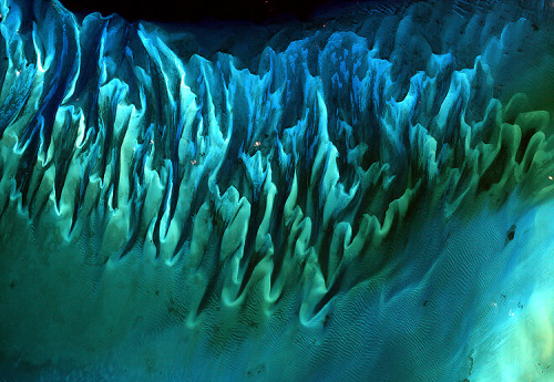
Though the above image may resemble a new age painting straight out of an art gallery in Venice Beach, California, it is in fact a satellite image of the sands and seaweed in the Bahamas. The image was taken by the Enhanced Thematic Mapper plus (ETM+) instrument aboard the Landsat 7 satellite. Tides and ocean currents in the Bahamas sculpted the sand and seaweed beds into these multicolored, fluted patterns in much the same way that winds sculpted the vast sand dunes in the Sahara Desert.

This beautiful image of Saturn and its rings looks more like an artist’s creation than a real image, but in fact, the image is a composite (layered image) made from 165 images taken by the wide-angle camera on the Cassini spacecraft over nearly three hours on September 15, 2006. Scientists created the color in the image by digitally compositing ultraviolet, infrared, and clear-filter images and then adjusting the final image to resemble natural color. (A clear filter is one that allows in all the wavelengths of light the sensor is capable of detecting.) This image is a closeup view of the upper left quadrant of the rings, through which Earth is visible in the far, far distance. The full image can be seen here.
Home Planet: Twin Marbles (#1 seed) vs. Fire in the Sky and on the Ground (#7 seed)

A day’s clouds. The shape and texture of the land. The living ocean. City lights as a beacon of human presence across the globe. This amazingly beautiful view of Earth from space is a fusion of science and art, a showcase for the remote-sensing technology that makes such views possible, and a testament to the passion and creativity of the scientists who devote their careers to understanding how land, ocean, and atmosphere—even life itself—interact to generate Earth’s unique (as far as we know!) life-sustaining environment.

Astronauts on the International Space Station (ISS) used a digital camera to capture several hundred photographs of the aurora australis, or “southern lights,” while passing over the Indian Ocean on September 17, 2011. If you click on this movie, you can see the flowing ribbons and rays below as the ISS passed from south of Madagascar to just north of Australia between 17:22 and 17:45 Universal Time. Solar panels and other sections of the ISS fill some of the upper right side of the photograph.
Auroras are a spectacular sign that our planet is electrically and magnetically connected to the Sun. These light shows are provoked by energy from the Sun and fueled by electrically charged particles trapped in Earth’s magnetic field, or magnetosphere. In this case, the space around Earth was stirred up by an explosion of hot, ionized gas from the Sun—a coronal mass ejection—that left the Sun on September 14, 2011.
Ice and Land: Sand Dunes (#8 seed) vs. Retreat of Columbia Glacier (#6 seed)

Mountains of sand, some as tall as 300 meters (1000 feet), reach from the floor of Africa’s Namib Desert toward the sky. Driven by wind, these dunes march across the desert, bordered to the west by the Atlantic Ocean and in other directions by solid, rocky land.
The abrupt transition from sand to land is visible in this image, acquired on November 13, 2019, by the Operational Land Imager (OLI) on Landsat 8. They show the northern extent of the Namib Sand Sea—a field of sand dunes spanning more than 3 million hectares (more than 10,000 square miles) within the Namib-Naukluft Park, which was named a UNESCO World Heritage site in 2013. Sand appears red, painted by a layer of iron oxide.


Scientists have long studied Alaska's fast-moving Columbia Glacier, a tidewater glacier that descends through the Chugach Mountains into Prince William Sound. Yet the river of ice continues to deliver new surprises.
The image series begins in July 1986 (bottom image) with a false-color image captured by the Thematic Mapper (TM) sensor on the Landsat 5 satellite. The false-color image from July 2014 (top image), acquired by the Operational Land Imager on the Landsat 8 satellite, shows the extent of retreat after 28 years. Use the image comparison tool to better see the details.
Sea and Sky: Atafu Atoll, Tokelau (#8 seed) vs. Raikoke Erupts (#6 seed)

At roughly eight kilometers wide, Atafu Atoll is the smallest of three atolls and one island (Nukunonu and Fakaofo Atolls to the southeast and Swains Island to the south are not shown) comprising the Tokelau Islands group located in the southern Pacific Ocean. The primary settlement on Atafu is a village located at the northwestern corner of the atoll. The typical ring shape of the atoll is the result of coral reefs building up around a former volcanic island.
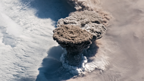
Unlike some of its perpetually active neighbors on the Kamchatka Peninsula, Raikoke Volcano on the Kuril Islands rarely erupts. The small, oval-shaped island most recently exploded in 1924 and in 1778.
The dormant period ended around 4:00 a.m. local time on June 22, 2019, when a vast plume of ash and volcanic gases shot up from its 700-meter-wide crater. Several satellites—as well as astronauts on the International Space Station—observed as a thick plume rose and then streamed east as it was pulled into the circulation of a storm in the North Pacific.
On the morning of June 22, astronauts shot this photograph of the volcanic plume rising in a narrow column and then spreading out in a part of the plume known as the umbrella region. That is the area where the density of the plume and the surrounding air equalize and the plume stops rising. The ring of clouds at the base of the column appears to be water vapor.
See all of the images and vote now HERE.
Make sure to follow us on Tumblr for your regular dose of space: http://nasa.tumblr.com.
Sit Back and Space Out
Peer out on the depths of universe from the cupola windows,
Meander through the hallways of space,
Float in the home office of the star sailors.
Allow yourself to - space out - and imagine life through the eyes of NASA Astronauts on the International Space Station.
Check out other ways to enjoy #NASAatHome, HERE. We've curated videos, activities and fun in one out-of-this world place.
Make sure to follow us on Tumblr for your regular dose of space: http://nasa.tumblr.com.
Choose Your Champion: Tournament Earth 2020
Tournament Earth is here! We want YOU to help us choose our best Earth image.

Since 1999, NASA Earth Observatory has published 16,000+ images. To celebrate our 20th anniversary and the 50th anniversary of Earth Day, we want you to pick our all-time best image. Each week from March 23 to April 28, you can vote for your favorite images. Readers will narrow the field from 32 nominees down to one champion in a five-round knockout-style tournament.
The nominees are separated into four groups: Past Winners, Home Planet, Land & Ice, and Sea & Sky.
Past Winners

No, that is not an animation of the death star orbiting Earth. It is the winner of Tournament Earth in 2016– the Dark Side and the Bright Side. The image shows the fully illuminated far side of the Moon that is not visible from Earth. Other contenders in this category are a picture of a volcanic eruption plume, sands and seas in the Bahamas, and lightning seen from the Space Station.
Home Planet

This picture of the Twin Blue Marbles is the number one seed in our "Home Planet" category, but that doesn't mean it's going to take home the crown. It has stiff competition from the iconic photo of Earth rising to an epic total solar eclipse to our Earth at night.

Land & Ice

Are you a land lover or ice lover? If you don't know, you might found out by browsing the beautiful imagery in this category. Vote on scenes from the partially frozen North Caspian Sea (above) to lava flowing in Iceland between the Bardarbunga and Askja volcanoes (below).

Sea & Sky

Hurricanes, lightning, and volcanic explosions are just a few of the amazing captures from NASA satellites and astronauts in this category.
The model-based visual above shows an expansive view of the mishmash of particles that dance and swirl through the atmosphere. It shows tropical cyclones, dust storms, and fires spreading tiny particles throughout the atmosphere during one day in August 2018.

Our satellites also capture the fine mixing of particles and churning of tides in our rivers. The image above shows dissolved organic matter from forests and wetlands that stained the water dark brown near Rupert Bay. A similar process darkens tea.
Learn more about Tournament Earth in the video below.
See all of the images and vote now HERE.
Make sure to follow us on Tumblr for your regular dose of space: http://nasa.tumblr.com.
Introducing Astronaut Story Time – from Earth! 📖
Tomorrow and each weekday at 4 p.m. EDT, record-breaking astronaut Christina Koch, who recently returned to our home planet after 328 days in space, will read a children’s book on HER Instagram Live!
👉🏽Follow @Astro_Christina to enjoy #NASAatHome ⏰Tap our story on Instagram to set a reminder to tune in If you want to learn more about life as one of our @NASAastronauts or you want to apply to #BeAnAstronaut, click HERE. Applications close in 5 days.
Make sure to follow us on Tumblr for your regular dose of space: http://nasa.tumblr.com.
“Only in the darkness can you see the stars.” —Martin Luther King, Jr. Pause for a moment and take in the vastness and beauty of our home planet captured from the vantage point of space. On this spaceship we call Earth, we are all in this together. 💙
Make sure to follow us on Tumblr for your regular dose of space: http://nasa.tumblr.com.
Take a moment, look outside your window. 🌷🌼
Today is the #FirstDayOfSpring in the Northern Hemisphere, also known as the vernal equinox.
#DYK Earth’s tilted axis causes the season? Throughout the year, different parts of Earth receive the Sun’s most direct rays. So, when the North Pole tilts toward the Sun, it’s summer in the Northern Hemisphere. And when the South Pole tilts toward the Sun, it’s winter in the Northern Hemisphere.
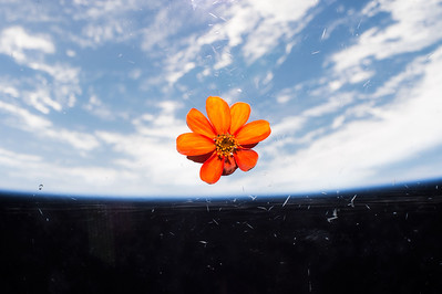
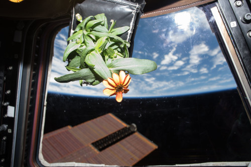
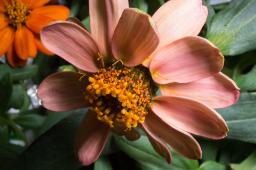
These images are of Zinnias. They are part of the flowering crop experiment that began aboard the International Space Station on Nov. 16, 2015, when NASA astronaut Kjell Lindgren activated the Veggie system and its rooting "pillows" containing zinnia seeds.
Make sure to follow us on Tumblr for your regular dose of space: http://nasa.tumblr.com.
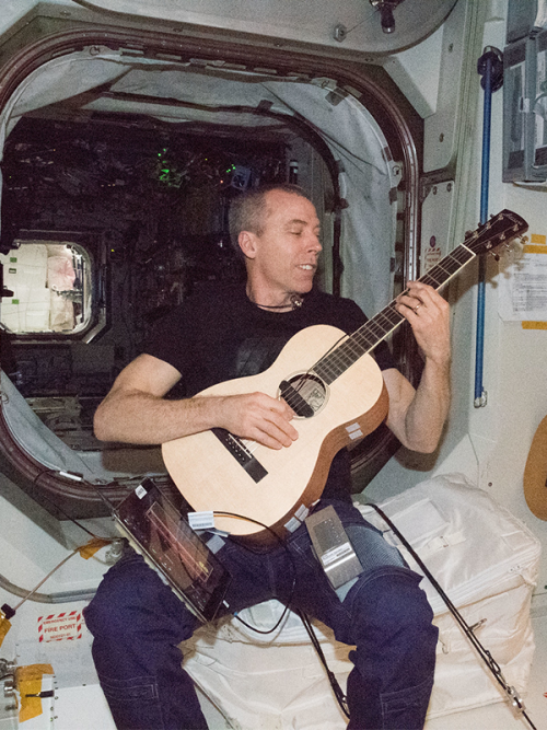
NASA Spotlight: Astronaut Andrew Feustel
Andrew J. Feustel was selected by NASA in 2000. The Lake Orion, Michigan native has a Ph.D. in the Geological Sciences, specializing in Seismology, and is a veteran of three spaceflights. In 2009, Dr. Feustel served on space shuttle mission STS-125. That mission was the fifth and final mission to service the Hubble Space Telescope that improved the observatory’s capabilities through 2014! Feustel most recently served as Commander on the International Space Station from March 21 through October 4, 2018. In his free time, Dr. Feustel enjoys auto restoration, guitar, water and snow skiing and is a fan of automotive and motorcycle racing.
He took some time from his job as a NASA astronaut to answer a few questions about his life and career! Enjoy:
While attending Oakland Community College, you worked as an auto mechanic. How does that job and the skills you learned relate to your job now as an astronaut?

I’ve often told people that I believe having this skillset is almost as important as my training in college and university. I relied on those skills almost every day in space and even on the ground while preparing for missions. That skillset has been really helpful in understanding how to maintain and repair equipment for spaceflight. In general, having those general skills of knowing how things fit together, what the structure is, and how things work, even without knowing anything about the particular item, is very helpful in life.
Has there ever been a time as a NASA Astronaut where you had to overcome self-doubt and if so, how did you?

Yes, probably the most impactful time I had to overcome self-doubt was on my very first mission as a rookie doing a spacewalk for the first time and having to make a repair on the Hubble Space Telescope. Since it was my first spacewalk, I didn’t know if I could do it and didn’t know how I would do. However, I had trained for that mission for three years and the training took over when I started the spacewalk. At that point, I didn’t focus on my self-doubt, I focused on my training and was able to carry out the tasks.
What are you most excited about for the upcoming Artemis Moon missions?
I am most excited about the possibility of humans establishing the ability to live off of our planet. To have the capability to exist on another surface. That, to me, is a start. Humans need that capability for us to live on the Moon then to go to Mars.
What did living in space teach you about community and teamwork?
Not just living in space, but working at NASA and training for space missions taught me a lot about community and teamwork. Living in space allows you to use the skills you learn about teamwork while training. While living in space you must rely on each other for everything. It’s important to recognize the value of working as a team. All of the astronauts have a very different mix of skills and that’s a great thing about the astronaut corps. Being successful and staying alive in space relies on community and teamwork.
What kind of impact did living and working in space have on how you view the Earth?

I am more aware of the fragility of our planet and species which is why humans should extend past the Earth. We are fragile as a planet and the Earth is vulnerable to the impacts of us living here. We cannot have zero impact on the planet, we will always have some impact, but the goal is to lessen the damage that we do to Earth to allow us to live here indefinitely if possible.
What or who inspired you to apply to be an astronaut?

I was inspired by reading the obituary of my great-great uncle. He was very successful in the utilities and railroad industry in the Midwest. Reading about his successes made me believe that I could do anything. I was also interested in space travel from a young age. I believed that I would be involved in the space industry. The motivation of understanding what family members had done before me really encouraged me to reach for my dreams and apply.
What book, movie, or show about space and/or astronauts is the most accurate? The least accurate? You wish was accurate?
I’m less concerned about the accuracy of space and space exploration portrayed in movies, but more interested with the creative thought behind them and I am fascinated with ideas and imagination of the people making these movies. Things portrayed as science fiction in the past become science fact in the future.
What's the most common misconception about astronauts / working at NASA?
The most common misconception about astronauts is that we go on spaceflights often. Over 95% of our job is spent working on the ground. People should come to this job because it’s important to space and space exploration. The job entails so much more than going into space yourself, but the good news is it’s all awesome. I have never been bored at my job. There are so many exciting parts of this work that contribute to NASA missions even if it doesn’t always mean being in space.
Can you share your favorite photo or video that you took in space?

My favorite photo is this one of Michigan and Canada. It captures my life – where I lived and everyone that I know and my family and friends – that’s where I consider home. It’s such a beautiful image.
That’s a wrap! Thank you Dr. Feustel for your time!
Make sure to follow us on Tumblr for your regular dose of space: http://nasa.tumblr.com.
Happy International Women’s Day!
Without the women of NASA, space exploration would be just a dream.
This International Women’s Day join us in celebrating the women whose grit, ingenuity and talent drives us forward in our mission to boldly expand frontiers in air and space. Thank you for pushing boundaries, serving as role models and shaping space, science and discovery every day!


The women at NASA are making history everyday! Keep up with their work and learn more about their stories, HERE.
Make sure to follow us on Tumblr for your regular dose of space: http://nasa.tumblr.com.
Employee Training – It’s Kind of a Big Deal
This is what it would look like if you were training to #BeAnAstronaut! Astronaut candidates must train for two years before they become official NASA astronauts. After graduation, you can look forward to more skill building when training for upcoming missions. Let’s dive into some of the courses you can expect once you’re selected for the job:
T-38 Jet Training

All astronaut candidates must learn to safely operate in a T-38 jet, either as a pilot or crew. Because this is the one area of their training that is not a simulation and involves decisions with life or death consequences, it teaches them to think quickly and clearly in dynamic situations.
Neutral Buoyancy Lab Training

The mission of the Neutral Buoyancy Lab (NBL) is to prepare astronauts for spacewalking outside the International Space Station! Astronauts are lowered into a large pool wearing full spacesuits. The pool is full of hardware that replicates what the space station is really like, so astronauts are able to practice tasks they can expect on a spacewalk such as going out the airlock, finding a good path to the work site and more! The NBL is beneficial because it gives astronauts the ability to be neutrally buoyant which simulates the effects of microgravity.
Geology Training

Geology training courses are specially tailored to the work astronauts will do from the International Space Station or on the next interplanetary mission! Astronauts learn the basic principles of geology, see rocks in their natural environment and handle samples from their class discussions. It’s less like memorizing the names of rocks and more like learning how geologists think and work.
Wilderness Survival Training

Before they end up in space, astronauts carry out a significant portion of their training in aircraft on Earth. It's unlikely, but possible, that one of those training planes could crash in a remote area and leave the humans on board to fend for themselves for a while. Knowing how to take care of their basic needs would be invaluable. Through the exercises, instructors hope to instill self-care and self-management skills, to develop teamwork skills, and to strengthen leadership abilities – all of which are valuable for working in the isolation of the wild or the isolation of space.
Extreme Environment Training

Astronauts participate in a variety of extreme environment training to prepare for the stresses of spaceflight. Pictured here, they are exploring the underground system of the Sa Grutta caves in Sardinia, Italy as a part of the European Astronaut Centre’s Cooperative Adventure for Valuing and Exercising human behavior and performance Skills (CAVES) expedition. Seasoned astronauts as well as rookies participate in the course and share experiences while learning how to improve leadership, teamwork, decision-making and problem-solving skills.
Virtual Reality Training

In our Virtual Reality Laboratory training facility at Johnson Space Center astronauts are able to immerse themselves in virtual reality to complete mission tasks and robotic operations before launching to space. The facility provides real time graphics and motion simulators integrated with a tendon-driven robotic device to provide the kinesthetic sensation of the mass and inertia characteristics of any large object (<500lb) being handled.
Want more? We’ve compiled all you need to know about what it takes to #BeAnAstronaut HERE.
Apply now, HERE!
Make sure to follow us on Tumblr for your regular dose of space: http://nasa.tumblr.com
Let It Snow for Science
When the weather outside is frightful…
Science in the field gets even more delightful. Two different missions are in the field right now, studying snow and how it affects communities around the country.
From our Wallops Flight Facility in Virginia, the IMPACTS mission is flying up and down the East Coast, investigating how snow forms inside clouds. In Grand Mesa, Colorado, SnowEx’s teams on the ground and in the air are taking a close look at how much water is stored in snow.

Hate going out in the storm? The IMPACTS mission can help with that! IMPACTS uses two planes – a P-3 Orion and an ER-2 – flying through and high above the clouds to study where intense bands of snowfall form. Better understanding where intense snow will fall can improve forecast models down the road — helping prepare communities for snowstorms.

Cameras mounted on the wings of the P3 took microscopic images of snowflakes, like this one.

At the same time, the SnowEx team is in Colorado, studying the depth and density of snow. Researchers are making radar spirals with snowmobiles and working in giant snow pits to measure things like snow water equivalent, or how much water is stored in snow.

SnowEx is helping us better understand snow’s role in ecosystems and human systems, like irrigation for agriculture. If you want to bring some corn for popping, SnowEx’s science can help grow that crop.

Follow along with our teams as they brave the cold and snow: https://twitter.com/nasaexpeditions
Make sure to follow us on Tumblr for your regular dose of space: http://nasa.tumblr.com
Satellite Data in Ag-tion: From Space to Your Plate
As Earth’s climate changes, some places are drying out and others are getting wetter, including the land that produces the food we eat. Farmers have to figure out how to adapt to changing climate conditions.

Our fleet of satellites has been watching over Earth for more than half a century. Some, like our joint Landsat mission with the U.S. Geological Survey (USGS), collect valuable data about the crops that make up our food supply and the water it takes to grow them.

Combining this wealth of satellite data with observations on the ground allows us to track how crop production changes over the years.
For example, this map shows how croplands have changed over the years to feed a growing population. The Agriculture Department (USDA) has used Landsat data since 2008 to track crops growing in the continental United States.

Agricultural scientists can even focus in on data for individual crops like corn, wheat and soybeans. They can look closely at regional crops, like citrus, that grow in only a few areas.

This nationwide view — provided by Landsat satellites orbiting 438 miles above Earth — is important to track the nation’s food supply. But with data from other satellites, like our ECOSTRESS instrument and ESA’s (the European Space Agency) Sentinel-2, agricultural scientists can monitor how healthy crops are in real time and predict when they’ll be ready to harvest.
In this false-color image of California farmland, red areas peak early in the season, whereas blue areas peak late. This information helps farmers watch over the plants in their fields, predict when they’ll be ready to harvest, and maximize crop production.

But while growing more and more crops sounds good, there can be challenges, like water. Especially when there’s not enough of it.
During California’s recent drought, just over 1 million acres of fertile farmland (shown in green) were fallow, or unused (red) in 2015. That’s nearly double the number of unused fields in 2011, the last year with normal rainfall before the drought.

Irrigating acres and acres of farmland takes lots of water. With remote sensing, scientists can track how irrigation fluctuates with climate change, new water management policies, or new technologies. Research like this helps farmers grow the most crops with the least amount of water.

As our climate changes, it’s more important than ever for farmers to have the knowledge they need to grow crops in a warming world. The data collected by our Earth-observing satellites help farmers learn about the planet that sustains us — and make better decisions about how to cultivate it.
Make sure to follow us on Tumblr for your regular dose of space: http://nasa.tumblr.com
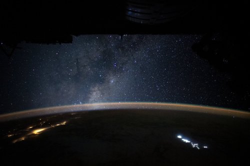
“We saw to the edge of all there is—
So brutal and alive it seemed to comprehend us back.”
-Tracy K. Smith, US Poet Laureate
Some pictures are worth a thousand words and some a thousand thoughts. On Jan. 31, astronaut Christina Koch shared this emotional view and quote from the International Space Station. Enjoy.
Make sure to follow us on Tumblr for your regular dose of space: http://nasa.tumblr.com
How is Biotechnology Preparing us to Live on the Moon and Mars?
The adventures awaiting astronauts on future long-duration missions have technologists researching sustainable ways to live away from Earth. We’re using what we know from almost 20 years of a continuous human presence on the International Space Station and looking at new technologies to prepare for missions to the Moon and Mars.

Biotechnology – technology that uses living organisms to make products that provide a new use – is key to this research.
With biotechnology, we’re developing new ways to manufacture medicines, build habitats and more in space. Here are some ways biotechnology is advancing spaceflight and how the same research is reaping benefits on Earth.

Healthy astronauts
Planning ways to supply food for a multi-year mission on the Moon or Mars may require making food and nutrients in space. Our scientists are testing an early version of a potential solution: get microorganisms to produce vital nutrients like those usually found in vegetables. Then, whenever they’re needed, astronauts can drink them down.
The microorganisms are genetically engineered to rapidly produce controlled quantities of essential nutrients. Because the microorganisms and their food source both have a long shelf-life at room temperature and only need water to be activated, the system provides a simple, practical way to produce essential nutrients on-demand. The same kind of system designed for space could also help provide nutrition for people in remote areas of our planet.
Our researchers are evaluating the first batches of BioNutrient samples that came back to Earth after an experimental run on the International Space Station.

Because space travel takes a toll on the human body, we’re also researching how biotechnology can be used to advance the field of regenerative medicine.
Related cells that are joined together are collectively referred to as tissue, and these cells work together as organs to accomplish specific functions in the human body. Blood vessels around the cells vascularize, providing nutrients to the tissue to keep it healthy.
Our Vascular Tissue Challenge offers a $500,000 prize to be divided among the first three teams that successfully create thick, metabolically-functional human vascularized organ tissue in a controlled laboratory environment. The vascularized, thick-tissue models resulting from this challenge will function as organ analogs, or models, that can be used to study deep space environmental effects, such as radiation, and to develop strategies to minimize the damage to healthy cells.
Plant factories
Humans have relied on plants’ medicinal qualities for thousands of years for everything from alleviating minor ailments to curing serious diseases. Now, researchers are trying to simplify the process of turning plants into medicine (i.e. how to make it compact and portable). If successful, the cost of biomanufacturing pharmaceuticals on Earth could go down, and plants could produce medicines in space.

Creating medicine on demand isn’t something we typically do, so we’re turning to experts in the field for help. Researchers at the University of California, Davis are transforming plants into mini-medicine factories for future Mars missions. They’re genetically altering an ordinary type of lettuce so that it produces a protein called parathyroid hormone. This hormone is an approved drug for treating osteoporosis, a common condition where bones become weak and brittle.

This type of research is important to long duration spaceflight. When astronauts land on Mars, they will have spent more than half a year in zero gravity on the flight there, and they’ll need to be strong and ready to explore. Having the technologies needed to treat that possibility, and other unanticipated health effects of long duration spaceflight, is crucial.
Growing habitats
Vitamins aren’t the only thing astronauts could be growing on Mars; we’re exploring technologies that could grow structures out of fungi.
An early-stage research project underway at our Ames Research Center is prototyping technologies that could "grow" habitats on the Moon, Mars and beyond out of life – specifically, fungi and the unseen underground threads that make up the main part of the fungus. These tiny threads build complex structures with extreme precision, networking out into larger structures like mushrooms. With the right conditions, they can be coaxed into making new structures – ranging from a material similar to leather to the building blocks for a planetary home.
The myco-architecture project envisions a future where astronauts can construct a habitat out of the lightweight fungi material. Upon arrival, by unfolding a basic structure made up of dormant fungi and simply adding water, the fungi would grow around that framework into a fully functional human habitat – all while being safely contained to avoid contaminating the external environment.

Recycling waste
Once astronauts arrive on the surface of the Moon or a more distant planet, they’ll have to carefully manage garbage. This waste includes some stuff that gets flushed on Earth.
Today, we’re already using a recycling system on the space station to turn urine into drinking water. Poop on the other hand is contained then disposed of on spacecraft returning to Earth. That won’t be possible on more distant journeys, so, we’re turning to biomanufacturing for a practical solution.
Biology can serve as an effective recycling factory. Microorganisms such as yeast and algae feed on all kinds of things classified as “mission waste.” Processing their preferred form of nourishment generates products that can serve as raw materials used to make essential supplies like nutrients, medicines, plastic and fuel.

By taking a careful look at biological processes, we hope to develop new, lightweight systems to leverage that biology to do some helpful in-space manufacturing.
From Space to Earth
Biotechnology is preparing us for longer space missions to the Moon and then Mars – farther from Earth than humans have ever traveled before. As we prepare for those exciting missions, we’re also conducting research on the space station for the primary benefit of everyone on Earth.
January is National Biotechnology Month. To learn more about some of the ways NASA is using biotechnology to solve challenges in space and improve life on Earth, visit this link.
Make sure to follow us on Tumblr for your regular dose of space: http://nasa.tumblr.com
Are We Alone? How NASA Is Trying to Answer This Question.
One of the greatest mysteries that life on Earth holds is, “Are we alone?”

At NASA, we are working hard to answer this question. We’re scouring the universe, hunting down planets that could potentially support life. Thanks to ground-based and space-based telescopes, including Kepler and TESS, we’ve found more than 4,000 planets outside our solar system, which are called exoplanets. Our search for new planets is ongoing — but we’re also trying to identify which of the 4,000 already discovered could be habitable.

Unfortunately, we can’t see any of these planets up close. The closest exoplanet to our solar system orbits the closest star to Earth, Proxima Centauri, which is just over 4 light years away. With today’s technology, it would take a spacecraft 75,000 years to reach this planet, known as Proxima Centauri b.
How do we investigate a planet that we can’t see in detail and can’t get to? How do we figure out if it could support life?
This is where computer models come into play. First we take the information that we DO know about a far-off planet: its size, mass and distance from its star. Scientists can infer these things by watching the light from a star dip as a planet crosses in front of it, or by measuring the gravitational tugging on a star as a planet circles it.
We put these scant physical details into equations that comprise up to a million lines of computer code. The code instructs our Discover supercomputer to use our rules of nature to simulate global climate systems. Discover is made of thousands of computers packed in racks the size of vending machines that hum in a deafening chorus of data crunching. Day and night, they spit out 7 quadrillion calculations per second — and from those calculations, we paint a picture of an alien world.

While modeling work can’t tell us if any exoplanet is habitable or not, it can tell us whether a planet is in the range of candidates to follow up with more intensive observations.

One major goal of simulating climates is to identify the most promising planets to turn to with future technology, like the James Webb Space Telescope, so that scientists can use limited and expensive telescope time most efficiently.

Additionally, these simulations are helping scientists create a catalog of potential chemical signatures that they might detect in the atmospheres of distant worlds. Having such a database to draw from will help them quickly determine the type of planet they’re looking at and decide whether to keep observing or turn their telescopes elsewhere.
Learn more about exoplanet exploration, here.
Make sure to follow us on Tumblr for your regular dose of space: http://nasa.tumblr.com.
What can you see from the space station? Can you see stars, the moon and sun, and Earth weather like lightening storms?
can you describe how earth looks like from space?
How has being in space changed your perspective of life on Earth?
2019 Temperature By the Numbers
The Year
2nd Hottest
2019 was the second-hottest year since modern record keeping began. NASA and the National Oceanic and Atmospheric Administration work together to track temperatures around the world and study how they change from year to year. For decades, the overall global temperature has been increasing.

Over the long term, world temperatures are warming, but each individual year is affected by things like El Niño ocean patterns and specific weather events.
The global temperature is an average, so not every place on Earth had its second-warmest year. For instance, the continental U.S. had a cold October, but Alaska set records for high temperatures. The U.S. was still warmer than average over the year.
Globally, Earth’s temperature in 2019 was more than 2°F warmer than the late 19th Century.
The Record
140 years
Since 1880, we can put together a consistent record of temperatures around the planet and see that it was much colder in the late-19th century. Before 1880, uncertainties in tracking global temperatures are larger. Temperatures have increased even faster since the 1970s, the result of increasing greenhouse gases in the atmosphere.

10 years
The last decade was the hottest decade on record.

20,000 Individual Observations
Scientists from NASA use data from more than 20,000 weather stations and Antarctic research stations, together with ship- and buoy-based observations of sea surface temperatures to track global temperatures.

The Consequences
90%
As Earth warms, polar ice is melting at an accelerated rate. The Arctic is warming even faster than the rest of the planet. This northern summer, 90% of the surface of the Greenland Ice Sheet melted.

8 inches
Melting ice raises sea levels around the world. While ice melts into the ocean, heat also causes the water to expand. Since 1880, sea levels globally have risen approximately 8 inches, although regional rates of sea level rise can be even higher.

100+ fires
As temperatures increase, fire seasons burn hotter and longer. During June and July 2019, more than 100 long-lived and intense wildfires burned north of the Arctic circle. This year also saw intense, record-setting fires in Australia.


46% increase in CO2 levels
This decades-long warming trend is the result of increasing greenhouse gases in the atmosphere, released by human activities.

Make sure to follow us on Tumblr for your regular dose of space: http://nasa.tumblr.com
That’s a wrap folks! Gucci is signing off. Thank you for all the amazing questions. Didn’t get your question answered? No worries! We’re coming to you live next week in our second Answer Time of 2020, featuring NASA Astronaut Nick Hague. Submit your questions now here: https://nasa.tumblr.com/ask

What are the moments when you think to yourself "yes. THIS is why I love my job"..? ✨